You are here: Home > Network List > GS - US Geological Survey Networks Stations List
> Station KAN11 Stewart Ranch, Harper County, KS, USA > Earthquake Result Viewer
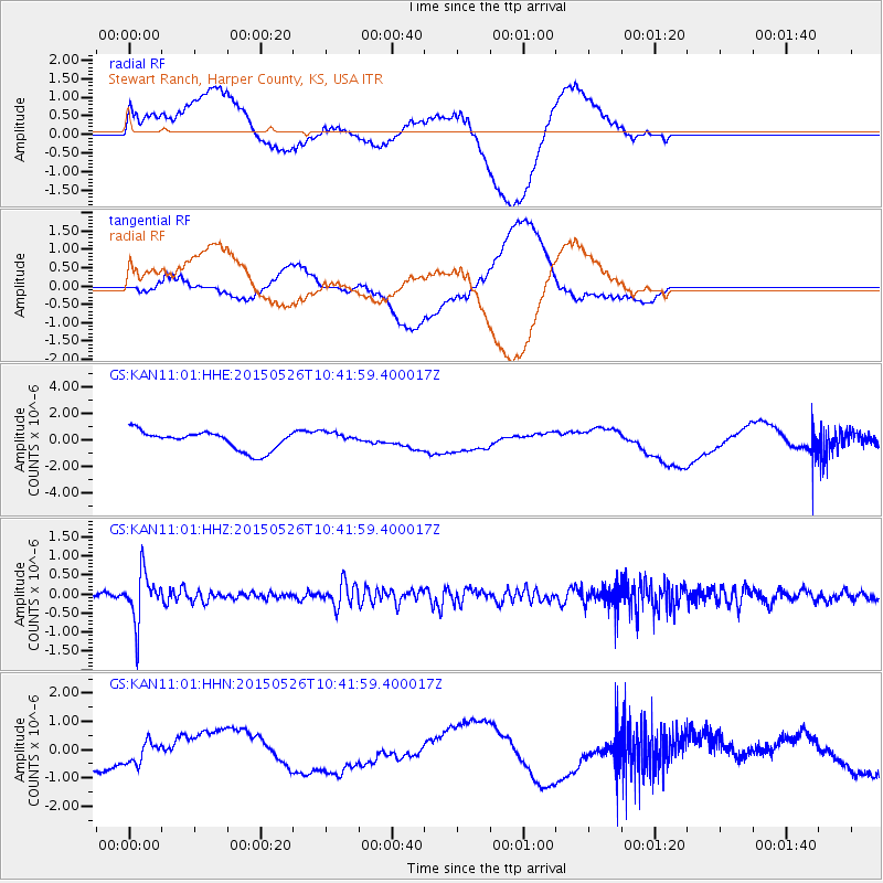
KAN11 Stewart Ranch, Harper County, KS, USA - Earthquake Result Viewer
*The percent match for this event was below the threshold and hence no stack was calculated.
| Earthquake location: |
Northern Chile |
| Earthquake latitude/longitude: |
-22.1/-68.4 |
| Earthquake time(UTC): |
2015/05/26 (146) 10:32:01 GMT |
| Earthquake Depth: |
115 km |
| Earthquake Magnitude: |
5.7 MB |
| Earthquake Catalog/Contributor: |
NEIC PDE/NEIC COMCAT |
|
| Network: |
GS US Geological Survey Networks |
| Station: |
KAN11 Stewart Ranch, Harper County, KS, USA |
| Lat/Lon: |
37.21 N/97.91 W |
| Elevation: |
410 m |
|
| Distance: |
65.2 deg |
| Az: |
334.349 deg |
| Baz: |
149.806 deg |
| Ray Param: |
$rayparam |
*The percent match for this event was below the threshold and hence was not used in the summary stack. |
|
| Radial Match: |
32.806908 % |
| Radial Bump: |
400 |
| Transverse Match: |
32.7851 % |
| Transverse Bump: |
400 |
| SOD ConfigId: |
976571 |
| Insert Time: |
2015-06-09 11:13:17.956 +0000 |
| GWidth: |
2.5 |
| Max Bumps: |
400 |
| Tol: |
0.001 |
|
Signal To Noise
| Channel | StoN | STA | LTA |
| GS:KAN11:01:HHZ:20150526T10:41:59.400017Z | 8.988677 | 6.484419E-7 | 7.213986E-8 |
| GS:KAN11:01:HHN:20150526T10:41:59.400017Z | 1.481919 | 3.8807468E-7 | 2.6187308E-7 |
| GS:KAN11:01:HHE:20150526T10:41:59.400017Z | 0.71981317 | 5.142237E-7 | 7.1438495E-7 |
| Arrivals |
| Ps | |
| PpPs | |
| PsPs/PpSs | |


