TATO Taipei, Taiwan - Earthquake Result Viewer
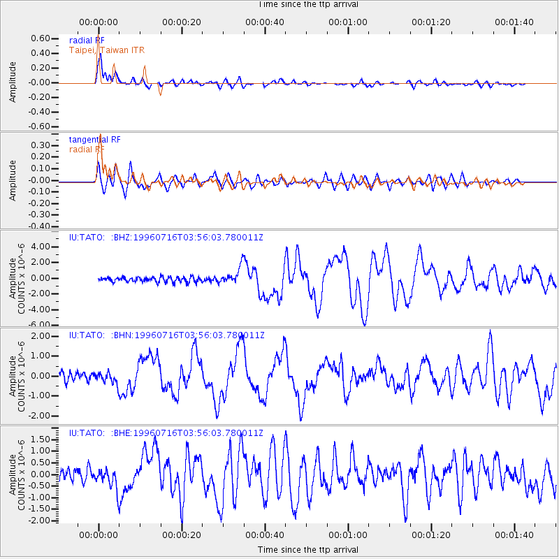
Earthquake location: Komandorskiye Ostrova Region
Earthquake latitude/longitude: 56.1/165.0
Earthquake time(UTC): 1996/07/16 (198) 03:48:28 GMT
Earthquake Depth: 33 km
Earthquake Magnitude: 5.8 MB, 6.4 MS, 6.5 UNKNOWN, 6.3 MW
Earthquake Catalog/Contributor: WHDF/NEIC
Network: IU Global Seismograph Network (GSN - IRIS/USGS)
Station: TATO Taipei, Taiwan
Lat/Lon: 24.98 N/121.49 E
Elevation: 53 m
Distance: 44.2 deg
Az: 243.635 deg
Baz: 33.601 deg
Ray Param: 0.07198825
Estimated Moho Depth: 23.5 km
Estimated Crust Vp/Vs: 2.09
Assumed Crust Vp: 6.289 km/s
Estimated Crust Vs: 3.009 km/s
Estimated Crust Poisson's Ratio: 0.35
Radial Match: 91.033775 %
Radial Bump: 400
Transverse Match: 79.627594 %
Transverse Bump: 400
SOD ConfigId: 6273
Insert Time: 2010-03-04 20:59:08.885 +0000
GWidth: 2.5
Max Bumps: 400
Tol: 0.001

Signal To Noise

ChannelStoNSTALTA
IU:TATO: :BHN:19960716T03:56:03.780011Z1.28206162.8800383E-72.2464117E-7
IU:TATO: :BHE:19960716T03:56:03.780011Z2.41611034.4163193E-71.8278632E-7
IU:TATO: :BHZ:19960716T03:56:03.780011Z3.80227021.1456897E-63.0131727E-7
Arrivals
Ps4.3 SECOND
PpPs11 SECOND
PsPs/PpSs15 SECOND