You are here: Home > Network List > IU - Global Seismograph Network (GSN - IRIS/USGS) Stations List
> Station TATO Taipei, Taiwan > Earthquake Result Viewer
TATO Taipei, Taiwan - Earthquake Result Viewer

| Earthquake location: |
Kermadec Islands Region |
| Earthquake latitude/longitude: |
-31.8/-179.4 |
| Earthquake time(UTC): |
1997/05/03 (123) 16:46:02 GMT |
| Earthquake Depth: |
108 km |
| Earthquake Magnitude: |
6.6 MB, 6.9 UNKNOWN, 6.8 ME |
| Earthquake Catalog/Contributor: |
WHDF/NEIC |
|
| Network: |
IU Global Seismograph Network (GSN - IRIS/USGS) |
| Station: |
TATO Taipei, Taiwan |
| Lat/Lon: |
24.98 N/121.49 E |
| Elevation: |
53 m |
|
| Distance: |
79.8 deg |
| Az: |
307.683 deg |
| Baz: |
132.05 deg |
| Ray Param: |
0.048441745 |
| Estimated Moho Depth: |
27.5 km |
| Estimated Crust Vp/Vs: |
1.82 |
| Assumed Crust Vp: |
6.289 km/s |
| Estimated Crust Vs: |
3.465 km/s |
| Estimated Crust Poisson's Ratio: |
0.28 |
|
| Radial Match: |
95.558266 % |
| Radial Bump: |
321 |
| Transverse Match: |
92.12221 % |
| Transverse Bump: |
373 |
| SOD ConfigId: |
6273 |
| Insert Time: |
2010-03-04 20:59:12.855 +0000 |
| GWidth: |
2.5 |
| Max Bumps: |
400 |
| Tol: |
0.001 |
|
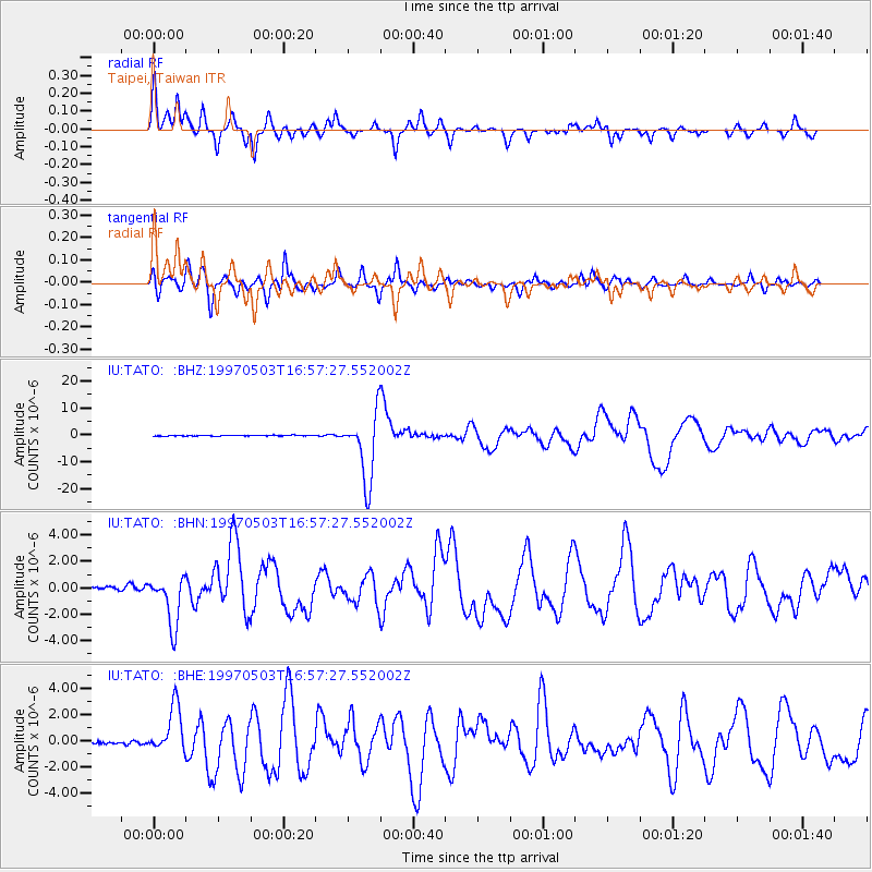
Signal To Noise
| Channel | StoN | STA | LTA |
| IU:TATO: :BHN:19970503T16:57:27.552002Z | 16.407022 | 1.9055541E-6 | 1.1614259E-7 |
| IU:TATO: :BHE:19970503T16:57:27.552002Z | 12.599771 | 1.8045191E-6 | 1.4321841E-7 |
| IU:TATO: :BHZ:19970503T16:57:27.552002Z | 92.530624 | 1.25554225E-5 | 1.3568938E-7 |
| Arrivals |
| Ps | 3.7 SECOND |
| PpPs | 12 SECOND |
| PsPs/PpSs | 16 SECOND |


