You are here: Home > Network List > CI - Caltech Regional Seismic Network Stations List
> Station GSC Goldstone, Goldstone Lake, CA, USA > Earthquake Result Viewer
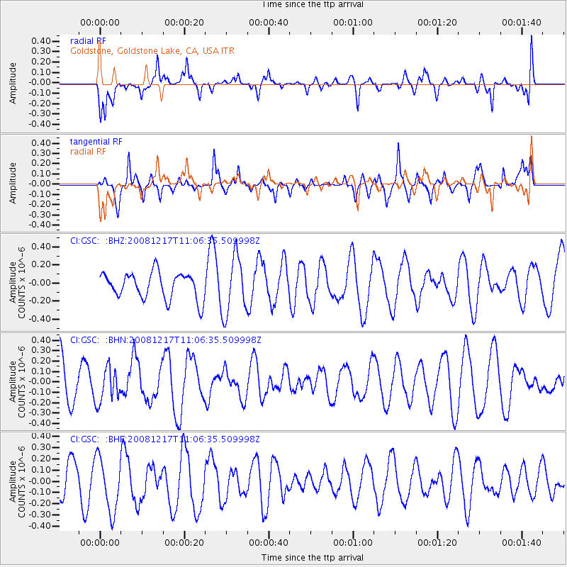
GSC Goldstone, Goldstone Lake, CA, USA - Earthquake Result Viewer
*The percent match for this event was below the threshold and hence no stack was calculated.
| Earthquake location: |
Fiji Islands Region |
| Earthquake latitude/longitude: |
-17.7/-178.4 |
| Earthquake time(UTC): |
2008/12/17 (352) 10:55:59 GMT |
| Earthquake Depth: |
530 km |
| Earthquake Magnitude: |
5.8 MW, 5.2 MB, 5.8 MW |
| Earthquake Catalog/Contributor: |
WHDF/NEIC |
|
| Network: |
CI Caltech Regional Seismic Network |
| Station: |
GSC Goldstone, Goldstone Lake, CA, USA |
| Lat/Lon: |
35.30 N/116.81 W |
| Elevation: |
1000 m |
|
| Distance: |
78.6 deg |
| Az: |
47.192 deg |
| Baz: |
238.736 deg |
| Ray Param: |
$rayparam |
*The percent match for this event was below the threshold and hence was not used in the summary stack. |
|
| Radial Match: |
60.00881 % |
| Radial Bump: |
400 |
| Transverse Match: |
52.489788 % |
| Transverse Bump: |
338 |
| SOD ConfigId: |
2658 |
| Insert Time: |
2010-02-25 23:51:20.462 +0000 |
| GWidth: |
2.5 |
| Max Bumps: |
400 |
| Tol: |
0.001 |
|
Signal To Noise
| Channel | StoN | STA | LTA |
| CI:GSC: :BHN:20081217T11:06:35.509998Z | 1.0292702 | 1.6381932E-7 | 1.5916066E-7 |
| CI:GSC: :BHE:20081217T11:06:35.509998Z | 0.9796441 | 2.4599183E-7 | 2.5110324E-7 |
| CI:GSC: :BHZ:20081217T11:06:35.509998Z | 2.2123437 | 3.2052571E-7 | 1.4488062E-7 |
| Arrivals |
| Ps | |
| PpPs | |
| PsPs/PpSs | |


