You are here: Home > Network List > TA - USArray Transportable Network (new EarthScope stations) Stations List
> Station A04D Lummi Island, WA, USA > Earthquake Result Viewer
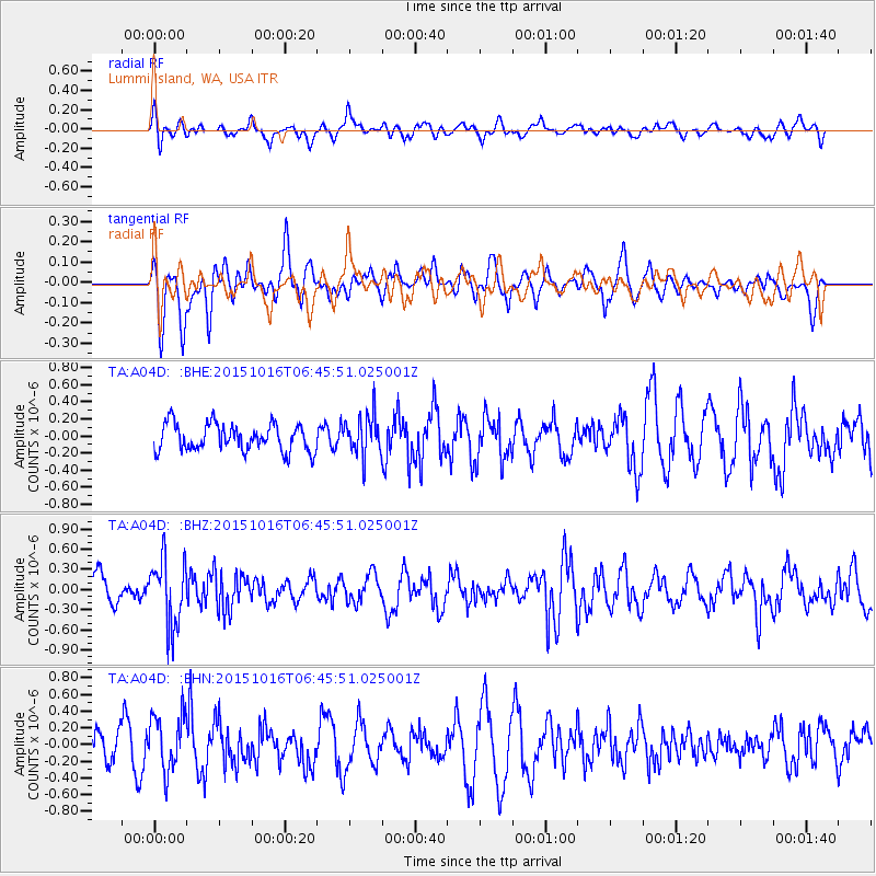
A04D Lummi Island, WA, USA - Earthquake Result Viewer
*The percent match for this event was below the threshold and hence no stack was calculated.
| Earthquake location: |
Kamchatka Peninsula, Russia |
| Earthquake latitude/longitude: |
55.6/159.2 |
| Earthquake time(UTC): |
2015/10/16 (289) 06:38:26 GMT |
| Earthquake Depth: |
285 km |
| Earthquake Magnitude: |
5.6 MWW, 5.7 MWB |
| Earthquake Catalog/Contributor: |
NEIC PDE/NEIC COMCAT |
|
| Network: |
TA USArray Transportable Network (new EarthScope stations) |
| Station: |
A04D Lummi Island, WA, USA |
| Lat/Lon: |
48.72 N/122.71 W |
| Elevation: |
13 m |
|
| Distance: |
46.0 deg |
| Az: |
64.238 deg |
| Baz: |
309.474 deg |
| Ray Param: |
$rayparam |
*The percent match for this event was below the threshold and hence was not used in the summary stack. |
|
| Radial Match: |
53.840824 % |
| Radial Bump: |
400 |
| Transverse Match: |
61.22625 % |
| Transverse Bump: |
400 |
| SOD ConfigId: |
7422571 |
| Insert Time: |
2019-04-21 03:08:00.551 +0000 |
| GWidth: |
2.5 |
| Max Bumps: |
400 |
| Tol: |
0.001 |
|
Signal To Noise
| Channel | StoN | STA | LTA |
| TA:A04D: :BHZ:20151016T06:45:51.025001Z | 1.7904252 | 5.036945E-7 | 2.8132672E-7 |
| TA:A04D: :BHN:20151016T06:45:51.025001Z | 1.3693333 | 3.357793E-7 | 2.452137E-7 |
| TA:A04D: :BHE:20151016T06:45:51.025001Z | 1.4755541 | 2.3322939E-7 | 1.5806224E-7 |
| Arrivals |
| Ps | |
| PpPs | |
| PsPs/PpSs | |


