You are here: Home > Network List > TA - USArray Transportable Network (new EarthScope stations) Stations List
> Station M53A WI Miller and Sons, Farmdale, OH, USA > Earthquake Result Viewer
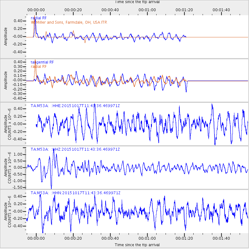
M53A WI Miller and Sons, Farmdale, OH, USA - Earthquake Result Viewer
*The percent match for this event was below the threshold and hence no stack was calculated.
| Earthquake location: |
Salta Province, Argentina |
| Earthquake latitude/longitude: |
-25.4/-64.4 |
| Earthquake time(UTC): |
2015/10/17 (290) 11:33:07 GMT |
| Earthquake Depth: |
8.2 km |
| Earthquake Magnitude: |
6.0 MB, 5.9 MWB |
| Earthquake Catalog/Contributor: |
NEIC PDE/NEIC COMCAT |
|
| Network: |
TA USArray Transportable Network (new EarthScope stations) |
| Station: |
M53A WI Miller and Sons, Farmdale, OH, USA |
| Lat/Lon: |
41.44 N/80.68 W |
| Elevation: |
334 m |
|
| Distance: |
68.2 deg |
| Az: |
346.912 deg |
| Baz: |
164.194 deg |
| Ray Param: |
$rayparam |
*The percent match for this event was below the threshold and hence was not used in the summary stack. |
|
| Radial Match: |
62.564804 % |
| Radial Bump: |
400 |
| Transverse Match: |
59.75215 % |
| Transverse Bump: |
400 |
| SOD ConfigId: |
7422571 |
| Insert Time: |
2019-04-21 03:18:02.211 +0000 |
| GWidth: |
2.5 |
| Max Bumps: |
400 |
| Tol: |
0.001 |
|
Signal To Noise
| Channel | StoN | STA | LTA |
| TA:M53A: :HHZ:20151017T11:43:36.469971Z | 2.230525 | 5.137146E-7 | 2.3031107E-7 |
| TA:M53A: :HHN:20151017T11:43:36.469971Z | 1.8327779 | 2.7721723E-7 | 1.5125522E-7 |
| TA:M53A: :HHE:20151017T11:43:36.469971Z | 1.517917 | 2.7091562E-7 | 1.7847854E-7 |
| Arrivals |
| Ps | |
| PpPs | |
| PsPs/PpSs | |


