
CIU CATALINA ISLAND - Earthquake Result Viewer
| ||||||||||||||||||
| ||||||||||||||||||
| ||||||||||||||||||
|
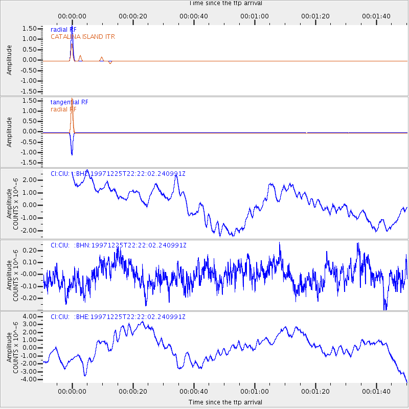
Signal To Noise
| Channel | StoN | STA | LTA |
| CI:CIU: :BHN:19971225T22:22:02.240991Z | 1.6059384 | 1.5493616E-7 | 9.6477024E-8 |
| CI:CIU: :BHE:19971225T22:22:02.240991Z | 0.9341353 | 8.5730835E-7 | 9.177561E-7 |
| CI:CIU: :BHZ:19971225T22:22:02.240991Z | 0.9696003 | 6.3697934E-7 | 6.569504E-7 |
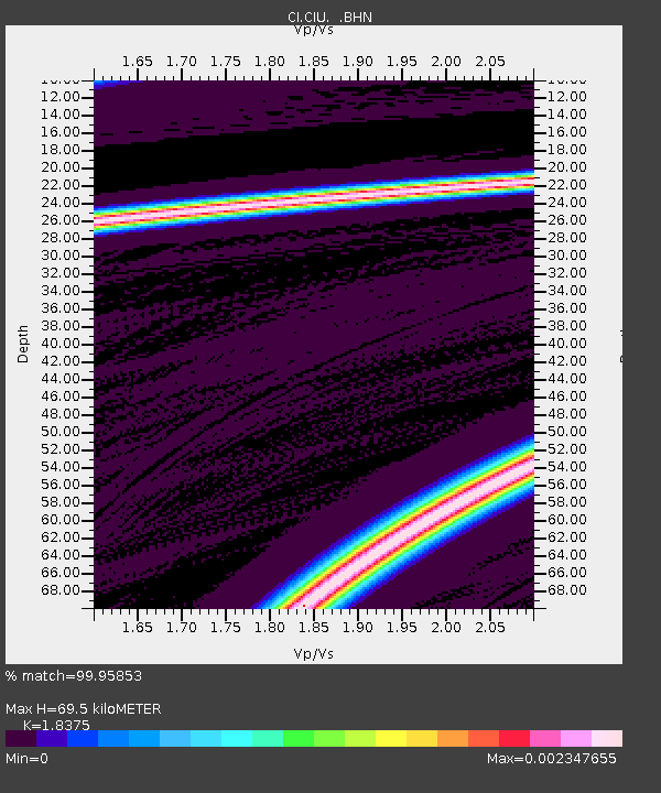
| Arrivals | |
| Ps | 10 SECOND |
| PpPs | 30 SECOND |
| PsPs/PpSs | 41 SECOND |

