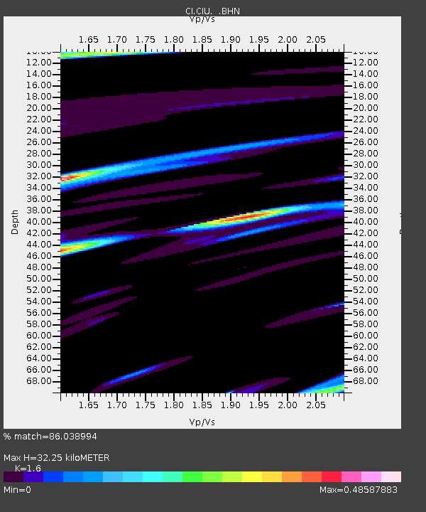
CIU CATALINA ISLAND - Earthquake Result Viewer
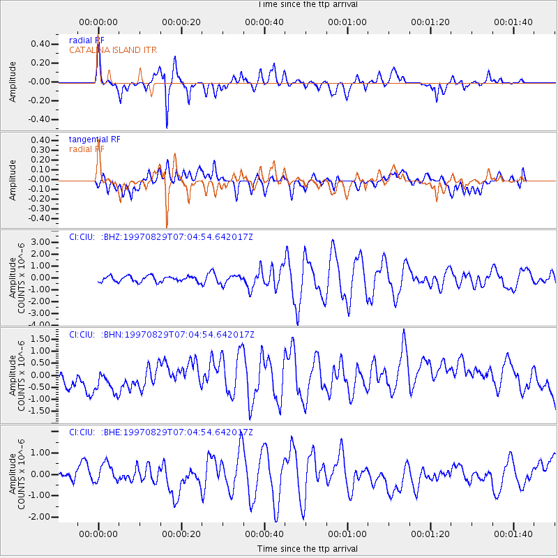
Earthquake location: Tonga Islands
Earthquake latitude/longitude: -15.2/-175.6
Earthquake time(UTC): 1997/08/29 (241) 06:54:00 GMT
Earthquake Depth: 33 km
Earthquake Magnitude: 5.6 MB, 6.4 MS, 6.5 UNKNOWN, 6.4 MW
Earthquake Catalog/Contributor: WHDF/NEIC
Network: CI Caltech Regional Seismic Network
Station: CIU CATALINA ISLAND
Lat/Lon: 33.45 N/118.48 W
Elevation: 203 m
Distance: 72.8 deg
Az: 47.282 deg
Baz: 238.019 deg
Ray Param: 0.053355772
Estimated Moho Depth: 32.25 km
Estimated Crust Vp/Vs: 1.60
Assumed Crust Vp: 6.048 km/s
Estimated Crust Vs: 3.78 km/s
Estimated Crust Poisson's Ratio: 0.18
Radial Match: 86.038994 %
Radial Bump: 400
Transverse Match: 22.437756 %
Transverse Bump: 400
SOD ConfigId: 4770
Insert Time: 2010-02-25 23:51:34.881 +0000
GWidth: 2.5
Max Bumps: 400
Tol: 0.001

Signal To Noise

ChannelStoNSTALTA
CI:CIU: :BHN:19970829T07:04:54.642017Z1.43319656.6066855E-74.6097557E-7
CI:CIU: :BHE:19970829T07:04:54.642017Z1.51331234.3810292E-72.8949933E-7
CI:CIU: :BHZ:19970829T07:04:54.642017Z1.45098013.5102934E-72.4192568E-7
Arrivals
Ps3.3 SECOND
PpPs13 SECOND
PsPs/PpSs17 SECOND