You are here: Home > Network List > KN - Kyrgyz Seismic Telemetry Network Stations List
> Station ULHL - > Earthquake Result Viewer
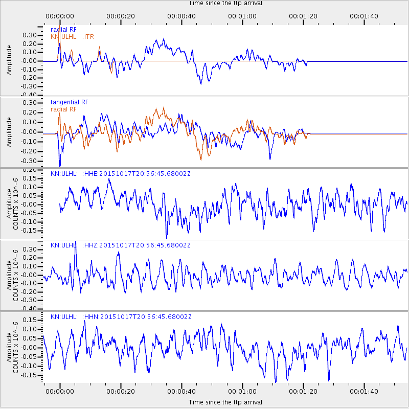
ULHL - - Earthquake Result Viewer
*The percent match for this event was below the threshold and hence no stack was calculated.
| Earthquake location: |
New Britain Region, P.N.G. |
| Earthquake latitude/longitude: |
-5.1/152.9 |
| Earthquake time(UTC): |
2015/10/17 (290) 20:44:53 GMT |
| Earthquake Depth: |
51 km |
| Earthquake Magnitude: |
5.4 mb |
| Earthquake Catalog/Contributor: |
NEIC PDE/us |
|
| Network: |
KN Kyrgyz Seismic Telemetry Network |
| Station: |
ULHL - |
| Lat/Lon: |
42.25 N/76.24 E |
| Elevation: |
2040 m |
|
| Distance: |
83.6 deg |
| Az: |
313.358 deg |
| Baz: |
102.73 deg |
| Ray Param: |
$rayparam |
*The percent match for this event was below the threshold and hence was not used in the summary stack. |
|
| Radial Match: |
31.97097 % |
| Radial Bump: |
400 |
| Transverse Match: |
43.212948 % |
| Transverse Bump: |
400 |
| SOD ConfigId: |
7422571 |
| Insert Time: |
2019-04-21 03:29:41.612 +0000 |
| GWidth: |
2.5 |
| Max Bumps: |
400 |
| Tol: |
0.001 |
|
Signal To Noise
| Channel | StoN | STA | LTA |
| KN:ULHL: :HHZ:20151017T20:56:45.68002Z | 2.0385675 | 7.553192E-8 | 3.7051464E-8 |
| KN:ULHL: :HHN:20151017T20:56:45.68002Z | 1.7029248 | 9.349835E-8 | 5.4904564E-8 |
| KN:ULHL: :HHE:20151017T20:56:45.68002Z | 1.5423971 | 6.5905326E-8 | 4.272915E-8 |
| Arrivals |
| Ps | |
| PpPs | |
| PsPs/PpSs | |


