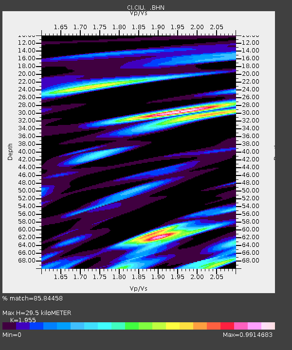
CIU CATALINA ISLAND - Earthquake Result Viewer
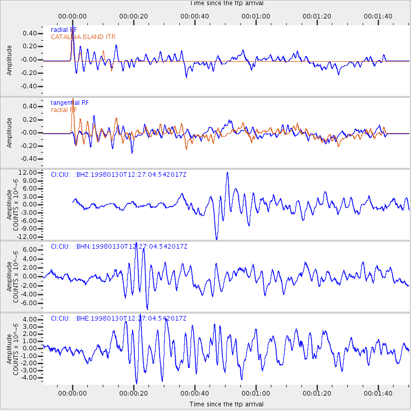
Earthquake location: Near Coast Of Northern Chile
Earthquake latitude/longitude: -23.9/-70.2
Earthquake time(UTC): 1998/01/30 (030) 12:16:08 GMT
Earthquake Depth: 42 km
Earthquake Magnitude: 6.3 MB, 6.5 MS, 7.0 UNKNOWN, 6.7 ME
Earthquake Catalog/Contributor: WHDF/NEIC
Network: CI Caltech Regional Seismic Network
Station: CIU CATALINA ISLAND
Lat/Lon: 33.45 N/118.48 W
Elevation: 203 m
Distance: 73.3 deg
Az: 319.332 deg
Baz: 134.496 deg
Ray Param: 0.053054087
Estimated Moho Depth: 29.5 km
Estimated Crust Vp/Vs: 1.96
Assumed Crust Vp: 6.048 km/s
Estimated Crust Vs: 3.094 km/s
Estimated Crust Poisson's Ratio: 0.32
Radial Match: 85.84458 %
Radial Bump: 400
Transverse Match: 68.87619 %
Transverse Bump: 400
SOD ConfigId: 6273
Insert Time: 2010-02-25 23:51:39.843 +0000
GWidth: 2.5
Max Bumps: 400
Tol: 0.001

Signal To Noise

ChannelStoNSTALTA
CI:CIU: :BHN:19980130T12:27:04.542017Z0.84754369.390719E-71.1079925E-6
CI:CIU: :BHE:19980130T12:27:04.542017Z1.21964381.2271599E-61.0061626E-6
CI:CIU: :BHZ:19980130T12:27:04.542017Z1.0019238.825448E-78.808509E-7
Arrivals
Ps4.8 SECOND
PpPs14 SECOND
PsPs/PpSs19 SECOND