You are here: Home > Network List > TA - USArray Transportable Network (new EarthScope stations) Stations List
> Station J04D Umpqua National Forest, Toketee, OR, USA > Earthquake Result Viewer
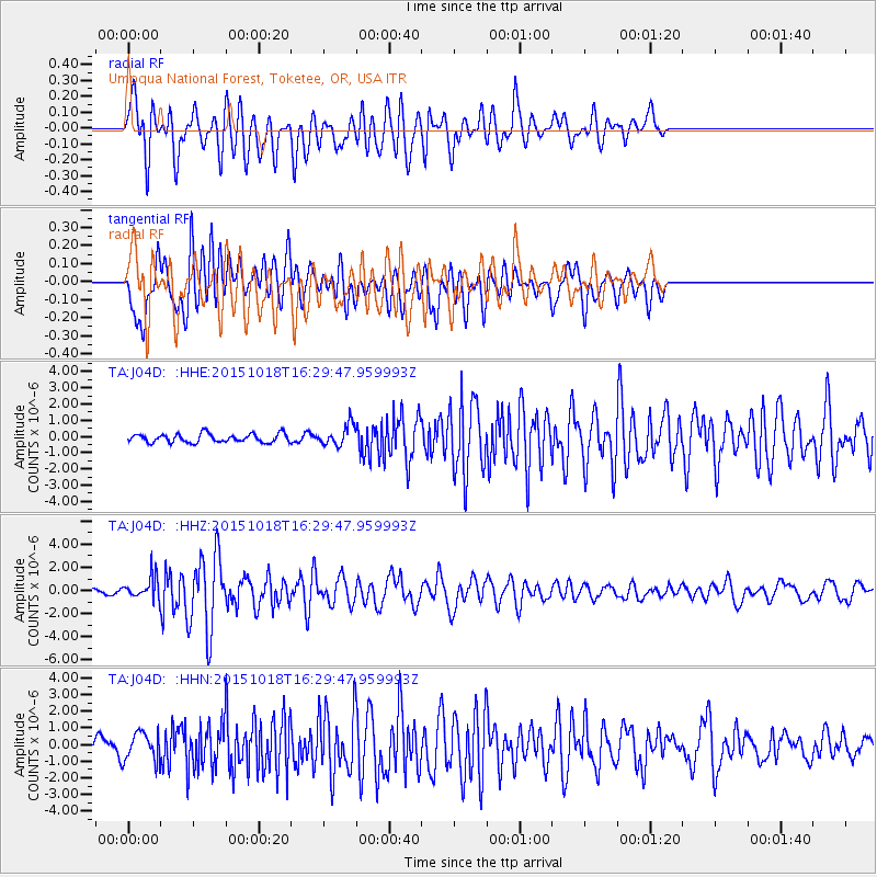
J04D Umpqua National Forest, Toketee, OR, USA - Earthquake Result Viewer
*The percent match for this event was below the threshold and hence no stack was calculated.
| Earthquake location: |
Tonga Islands |
| Earthquake latitude/longitude: |
-16.3/-173.2 |
| Earthquake time(UTC): |
2015/10/18 (291) 16:18:35 GMT |
| Earthquake Depth: |
10 km |
| Earthquake Magnitude: |
5.9 MWB |
| Earthquake Catalog/Contributor: |
NEIC PDE/NEIC COMCAT |
|
| Network: |
TA USArray Transportable Network (new EarthScope stations) |
| Station: |
J04D Umpqua National Forest, Toketee, OR, USA |
| Lat/Lon: |
43.24 N/122.11 W |
| Elevation: |
1948 m |
|
| Distance: |
75.5 deg |
| Az: |
35.969 deg |
| Baz: |
230.535 deg |
| Ray Param: |
$rayparam |
*The percent match for this event was below the threshold and hence was not used in the summary stack. |
|
| Radial Match: |
75.60052 % |
| Radial Bump: |
400 |
| Transverse Match: |
72.1845 % |
| Transverse Bump: |
400 |
| SOD ConfigId: |
7422571 |
| Insert Time: |
2019-04-21 03:39:40.151 +0000 |
| GWidth: |
2.5 |
| Max Bumps: |
400 |
| Tol: |
0.001 |
|
Signal To Noise
| Channel | StoN | STA | LTA |
| TA:J04D: :HHZ:20151018T16:29:47.959993Z | 3.8024104 | 9.855206E-7 | 2.5918314E-7 |
| TA:J04D: :HHN:20151018T16:29:47.959993Z | 2.0594673 | 8.391262E-7 | 4.0744817E-7 |
| TA:J04D: :HHE:20151018T16:29:47.959993Z | 2.4146738 | 6.355042E-7 | 2.631843E-7 |
| Arrivals |
| Ps | |
| PpPs | |
| PsPs/PpSs | |


