You are here: Home > Network List > TA - USArray Transportable Network (new EarthScope stations) Stations List
> Station J05D Fort Rock, OR, USA > Earthquake Result Viewer
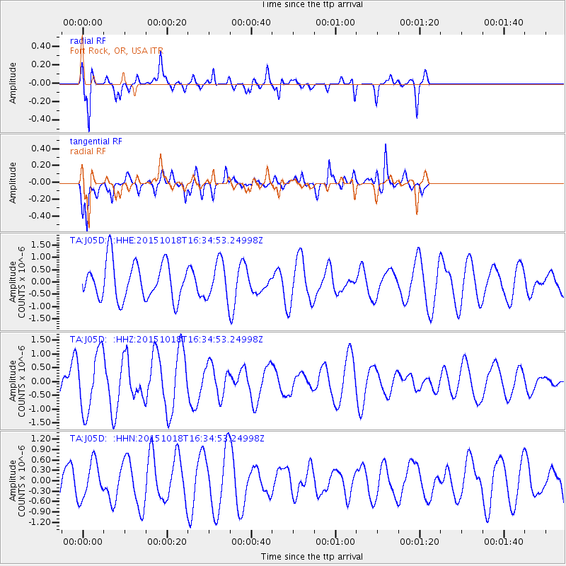
J05D Fort Rock, OR, USA - Earthquake Result Viewer
*The percent match for this event was below the threshold and hence no stack was calculated.
| Earthquake location: |
Tonga Islands |
| Earthquake latitude/longitude: |
-16.1/-173.3 |
| Earthquake time(UTC): |
2015/10/18 (291) 16:23:37 GMT |
| Earthquake Depth: |
10 km |
| Earthquake Magnitude: |
5.1 mb |
| Earthquake Catalog/Contributor: |
NEIC PDE/us |
|
| Network: |
TA USArray Transportable Network (new EarthScope stations) |
| Station: |
J05D Fort Rock, OR, USA |
| Lat/Lon: |
43.28 N/121.23 W |
| Elevation: |
1541 m |
|
| Distance: |
75.9 deg |
| Az: |
36.427 deg |
| Baz: |
231.408 deg |
| Ray Param: |
$rayparam |
*The percent match for this event was below the threshold and hence was not used in the summary stack. |
|
| Radial Match: |
73.169235 % |
| Radial Bump: |
330 |
| Transverse Match: |
74.74418 % |
| Transverse Bump: |
400 |
| SOD ConfigId: |
7422571 |
| Insert Time: |
2019-04-21 03:48:34.241 +0000 |
| GWidth: |
2.5 |
| Max Bumps: |
400 |
| Tol: |
0.001 |
|
Signal To Noise
| Channel | StoN | STA | LTA |
| TA:J05D: :HHZ:20151018T16:34:53.24998Z | 1.7814171 | 1.1001474E-6 | 6.175687E-7 |
| TA:J05D: :HHN:20151018T16:34:53.24998Z | 1.1448332 | 5.2784577E-7 | 4.6106786E-7 |
| TA:J05D: :HHE:20151018T16:34:53.24998Z | 1.0326207 | 7.6917956E-7 | 7.4488105E-7 |
| Arrivals |
| Ps | |
| PpPs | |
| PsPs/PpSs | |


