You are here: Home > Network List > TA - USArray Transportable Network (new EarthScope stations) Stations List
> Station J26L Joseph Creek, AK, USA > Earthquake Result Viewer
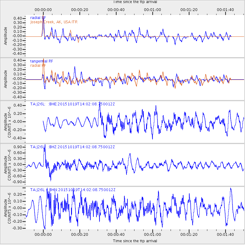
J26L Joseph Creek, AK, USA - Earthquake Result Viewer
*The percent match for this event was below the threshold and hence no stack was calculated.
| Earthquake location: |
Mindoro, Philippines |
| Earthquake latitude/longitude: |
13.9/120.6 |
| Earthquake time(UTC): |
2015/10/19 (292) 13:50:41 GMT |
| Earthquake Depth: |
106 km |
| Earthquake Magnitude: |
5.8 MWB, 5.9 MWC |
| Earthquake Catalog/Contributor: |
NEIC PDE/NEIC COMCAT |
|
| Network: |
TA USArray Transportable Network (new EarthScope stations) |
| Station: |
J26L Joseph Creek, AK, USA |
| Lat/Lon: |
64.50 N/143.56 W |
| Elevation: |
1144 m |
|
| Distance: |
80.1 deg |
| Az: |
25.92 deg |
| Baz: |
281.23 deg |
| Ray Param: |
$rayparam |
*The percent match for this event was below the threshold and hence was not used in the summary stack. |
|
| Radial Match: |
58.731148 % |
| Radial Bump: |
400 |
| Transverse Match: |
62.24549 % |
| Transverse Bump: |
400 |
| SOD ConfigId: |
7422571 |
| Insert Time: |
2019-04-21 03:55:14.457 +0000 |
| GWidth: |
2.5 |
| Max Bumps: |
400 |
| Tol: |
0.001 |
|
Signal To Noise
| Channel | StoN | STA | LTA |
| TA:J26L: :BHZ:20151019T14:02:08.750012Z | 3.789063 | 4.3878762E-7 | 1.1580373E-7 |
| TA:J26L: :BHN:20151019T14:02:08.750012Z | 2.4401777 | 1.890571E-7 | 7.7476784E-8 |
| TA:J26L: :BHE:20151019T14:02:08.750012Z | 2.8885849 | 2.3433579E-7 | 8.1124774E-8 |
| Arrivals |
| Ps | |
| PpPs | |
| PsPs/PpSs | |


