You are here: Home > Network List > AZ - ANZA Regional Network Stations List
> Station SMER AZ.SMER > Earthquake Result Viewer
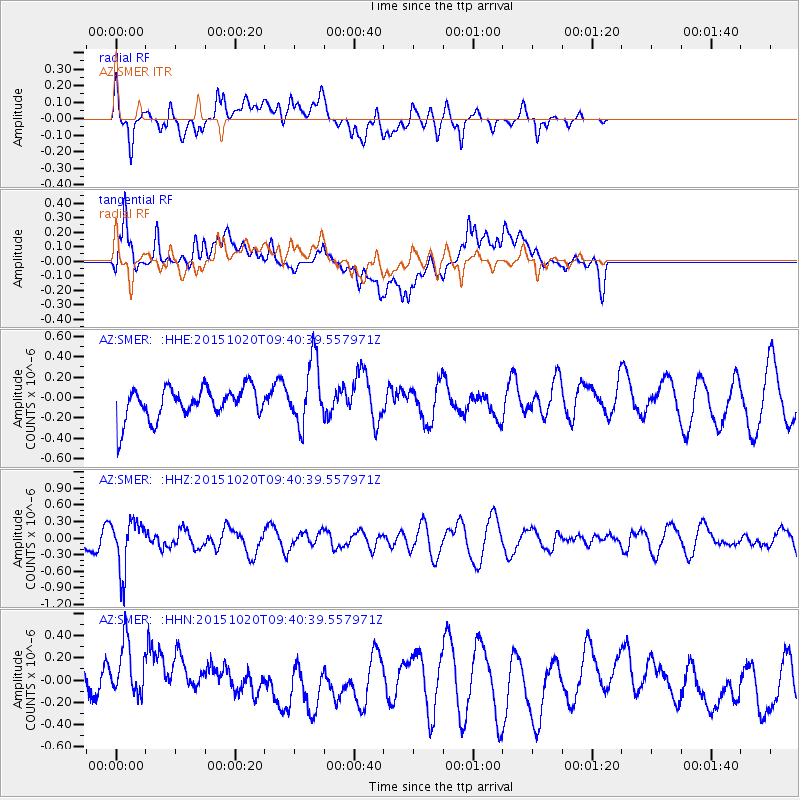
SMER AZ.SMER - Earthquake Result Viewer
*The percent match for this event was below the threshold and hence no stack was calculated.
| Earthquake location: |
Bonin Islands, Japan Region |
| Earthquake latitude/longitude: |
27.0/140.3 |
| Earthquake time(UTC): |
2015/10/20 (293) 09:29:08 GMT |
| Earthquake Depth: |
300 km |
| Earthquake Magnitude: |
5.5 MB |
| Earthquake Catalog/Contributor: |
NEIC PDE/NEIC COMCAT |
|
| Network: |
AZ ANZA Regional Network |
| Station: |
SMER AZ.SMER |
| Lat/Lon: |
33.46 N/117.17 W |
| Elevation: |
355 m |
|
| Distance: |
85.1 deg |
| Az: |
54.983 deg |
| Baz: |
299.093 deg |
| Ray Param: |
$rayparam |
*The percent match for this event was below the threshold and hence was not used in the summary stack. |
|
| Radial Match: |
51.70601 % |
| Radial Bump: |
400 |
| Transverse Match: |
42.7655 % |
| Transverse Bump: |
400 |
| SOD ConfigId: |
7422571 |
| Insert Time: |
2019-04-21 03:59:45.561 +0000 |
| GWidth: |
2.5 |
| Max Bumps: |
400 |
| Tol: |
0.001 |
|
Signal To Noise
| Channel | StoN | STA | LTA |
| AZ:SMER: :HHZ:20151020T09:40:39.557971Z | 3.458391 | 4.4788706E-7 | 1.2950736E-7 |
| AZ:SMER: :HHN:20151020T09:40:39.557971Z | 1.7818856 | 3.1834696E-7 | 1.7865734E-7 |
| AZ:SMER: :HHE:20151020T09:40:39.557971Z | 2.0123918 | 3.1399682E-7 | 1.5603165E-7 |
| Arrivals |
| Ps | |
| PpPs | |
| PsPs/PpSs | |


