You are here: Home > Network List > CI - Caltech Regional Seismic Network Stations List
> Station SWS Sam W. Stewart, Westmorland, CA, USA > Earthquake Result Viewer
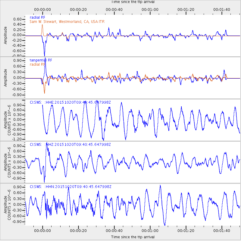
SWS Sam W. Stewart, Westmorland, CA, USA - Earthquake Result Viewer
*The percent match for this event was below the threshold and hence no stack was calculated.
| Earthquake location: |
Bonin Islands, Japan Region |
| Earthquake latitude/longitude: |
27.0/140.3 |
| Earthquake time(UTC): |
2015/10/20 (293) 09:29:08 GMT |
| Earthquake Depth: |
300 km |
| Earthquake Magnitude: |
5.5 MB |
| Earthquake Catalog/Contributor: |
NEIC PDE/NEIC COMCAT |
|
| Network: |
CI Caltech Regional Seismic Network |
| Station: |
SWS Sam W. Stewart, Westmorland, CA, USA |
| Lat/Lon: |
32.94 N/115.80 W |
| Elevation: |
140 m |
|
| Distance: |
86.3 deg |
| Az: |
54.865 deg |
| Baz: |
299.833 deg |
| Ray Param: |
$rayparam |
*The percent match for this event was below the threshold and hence was not used in the summary stack. |
|
| Radial Match: |
56.87471 % |
| Radial Bump: |
332 |
| Transverse Match: |
68.23819 % |
| Transverse Bump: |
351 |
| SOD ConfigId: |
7422571 |
| Insert Time: |
2019-04-21 04:00:50.610 +0000 |
| GWidth: |
2.5 |
| Max Bumps: |
400 |
| Tol: |
0.001 |
|
Signal To Noise
| Channel | StoN | STA | LTA |
| CI:SWS: :HHZ:20151020T09:40:45.647998Z | 1.8936139 | 6.2088014E-7 | 3.2788105E-7 |
| CI:SWS: :HHN:20151020T09:40:45.647998Z | 1.4367312 | 3.8842725E-7 | 2.7035486E-7 |
| CI:SWS: :HHE:20151020T09:40:45.647998Z | 1.291983 | 7.802734E-7 | 6.039348E-7 |
| Arrivals |
| Ps | |
| PpPs | |
| PsPs/PpSs | |


