You are here: Home > Network List > KN - Kyrgyz Seismic Telemetry Network Stations List
> Station CHM KN.CHM > Earthquake Result Viewer
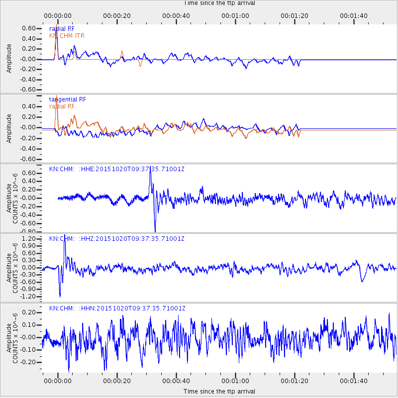
CHM KN.CHM - Earthquake Result Viewer
*The percent match for this event was below the threshold and hence no stack was calculated.
| Earthquake location: |
Bonin Islands, Japan Region |
| Earthquake latitude/longitude: |
27.0/140.3 |
| Earthquake time(UTC): |
2015/10/20 (293) 09:29:08 GMT |
| Earthquake Depth: |
300 km |
| Earthquake Magnitude: |
5.5 MB |
| Earthquake Catalog/Contributor: |
NEIC PDE/NEIC COMCAT |
|
| Network: |
KN Kyrgyz Seismic Telemetry Network |
| Station: |
CHM KN.CHM |
| Lat/Lon: |
43.00 N/74.75 E |
| Elevation: |
655 m |
|
| Distance: |
54.7 deg |
| Az: |
305.066 deg |
| Baz: |
84.342 deg |
| Ray Param: |
$rayparam |
*The percent match for this event was below the threshold and hence was not used in the summary stack. |
|
| Radial Match: |
68.04051 % |
| Radial Bump: |
400 |
| Transverse Match: |
56.17912 % |
| Transverse Bump: |
400 |
| SOD ConfigId: |
7422571 |
| Insert Time: |
2019-04-21 04:02:24.608 +0000 |
| GWidth: |
2.5 |
| Max Bumps: |
400 |
| Tol: |
0.001 |
|
Signal To Noise
| Channel | StoN | STA | LTA |
| KN:CHM: :HHZ:20151020T09:37:35.71001Z | 5.2591615 | 5.201156E-7 | 9.8897054E-8 |
| KN:CHM: :HHN:20151020T09:37:35.71001Z | 1.6204238 | 1.3261034E-7 | 8.183682E-8 |
| KN:CHM: :HHE:20151020T09:37:35.71001Z | 4.7410536 | 3.125936E-7 | 6.5933364E-8 |
| Arrivals |
| Ps | |
| PpPs | |
| PsPs/PpSs | |


