You are here: Home > Network List > TA - USArray Transportable Network (new EarthScope stations) Stations List
> Station A21K Barrow, AK, USA > Earthquake Result Viewer
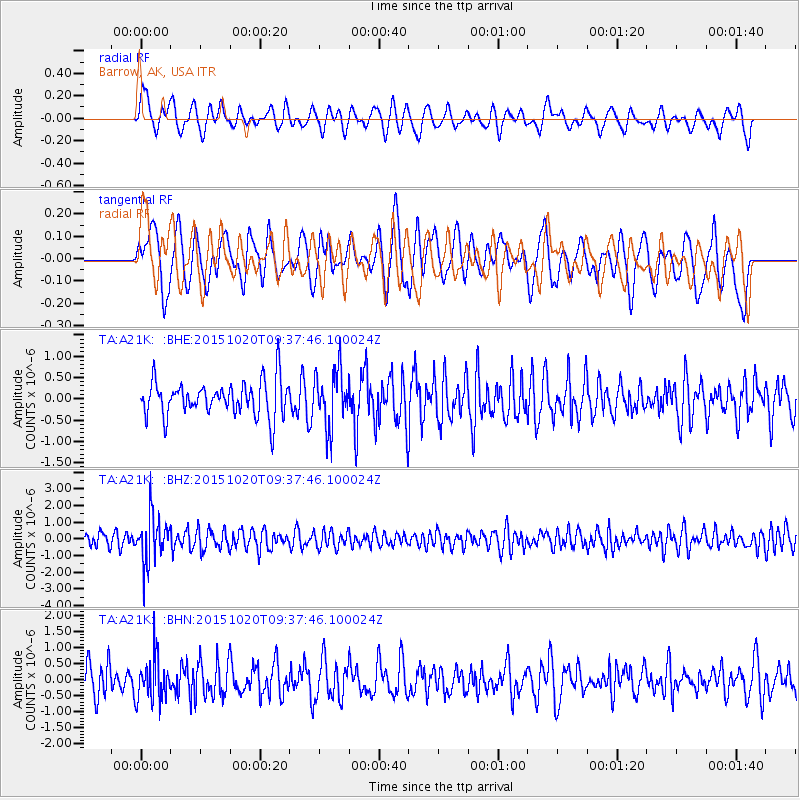
A21K Barrow, AK, USA - Earthquake Result Viewer
*The percent match for this event was below the threshold and hence no stack was calculated.
| Earthquake location: |
Bonin Islands, Japan Region |
| Earthquake latitude/longitude: |
27.0/140.3 |
| Earthquake time(UTC): |
2015/10/20 (293) 09:29:08 GMT |
| Earthquake Depth: |
300 km |
| Earthquake Magnitude: |
5.5 MB |
| Earthquake Catalog/Contributor: |
NEIC PDE/NEIC COMCAT |
|
| Network: |
TA USArray Transportable Network (new EarthScope stations) |
| Station: |
A21K Barrow, AK, USA |
| Lat/Lon: |
71.32 N/156.62 W |
| Elevation: |
577 m |
|
| Distance: |
56.1 deg |
| Az: |
20.259 deg |
| Baz: |
253.47 deg |
| Ray Param: |
$rayparam |
*The percent match for this event was below the threshold and hence was not used in the summary stack. |
|
| Radial Match: |
60.341022 % |
| Radial Bump: |
400 |
| Transverse Match: |
49.534702 % |
| Transverse Bump: |
400 |
| SOD ConfigId: |
7422571 |
| Insert Time: |
2019-04-21 04:04:44.760 +0000 |
| GWidth: |
2.5 |
| Max Bumps: |
400 |
| Tol: |
0.001 |
|
Signal To Noise
| Channel | StoN | STA | LTA |
| TA:A21K: :BHZ:20151020T09:37:46.100024Z | 2.5874574 | 1.426192E-6 | 5.511943E-7 |
| TA:A21K: :BHN:20151020T09:37:46.100024Z | 1.4554224 | 6.586736E-7 | 4.525653E-7 |
| TA:A21K: :BHE:20151020T09:37:46.100024Z | 1.5791945 | 6.531145E-7 | 4.1357447E-7 |
| Arrivals |
| Ps | |
| PpPs | |
| PsPs/PpSs | |


