You are here: Home > Network List > TA - USArray Transportable Network (new EarthScope stations) Stations List
> Station J05D Fort Rock, OR, USA > Earthquake Result Viewer
J05D Fort Rock, OR, USA - Earthquake Result Viewer
*The percent match for this event was below the threshold and hence no stack was calculated.
| Earthquake location: |
Bonin Islands, Japan Region |
| Earthquake latitude/longitude: |
27.0/140.3 |
| Earthquake time(UTC): |
2015/10/20 (293) 09:29:08 GMT |
| Earthquake Depth: |
300 km |
| Earthquake Magnitude: |
5.5 MB |
| Earthquake Catalog/Contributor: |
NEIC PDE/NEIC COMCAT |
|
| Network: |
TA USArray Transportable Network (new EarthScope stations) |
| Station: |
J05D Fort Rock, OR, USA |
| Lat/Lon: |
43.28 N/121.23 W |
| Elevation: |
1541 m |
|
| Distance: |
77.7 deg |
| Az: |
47.656 deg |
| Baz: |
295.471 deg |
| Ray Param: |
$rayparam |
*The percent match for this event was below the threshold and hence was not used in the summary stack. |
|
| Radial Match: |
57.332947 % |
| Radial Bump: |
400 |
| Transverse Match: |
62.95138 % |
| Transverse Bump: |
400 |
| SOD ConfigId: |
7422571 |
| Insert Time: |
2019-04-21 04:05:02.088 +0000 |
| GWidth: |
2.5 |
| Max Bumps: |
400 |
| Tol: |
0.001 |
|
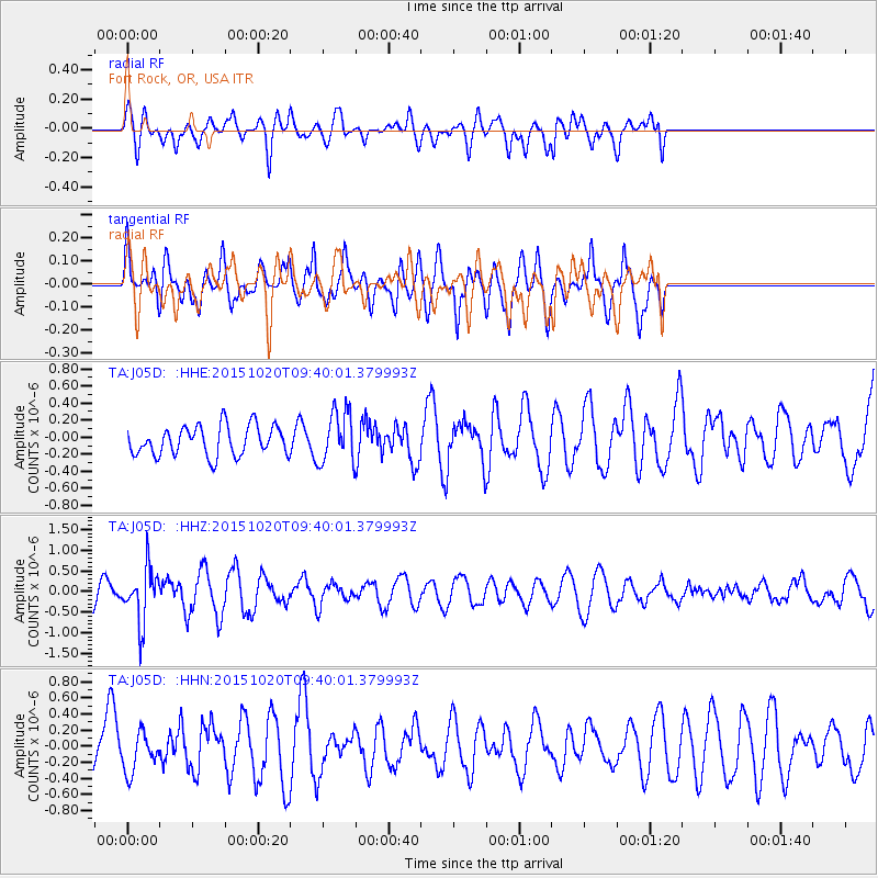
Signal To Noise
| Channel | StoN | STA | LTA |
| TA:J05D: :HHZ:20151020T09:40:01.379993Z | 1.9665296 | 6.4827327E-7 | 3.2965343E-7 |
| TA:J05D: :HHN:20151020T09:40:01.379993Z | 0.71491593 | 2.3548955E-7 | 3.2939474E-7 |
| TA:J05D: :HHE:20151020T09:40:01.379993Z | 1.783683 | 3.085673E-7 | 1.7299449E-7 |
| Arrivals |
| Ps | |
| PpPs | |
| PsPs/PpSs | |


