You are here: Home > Network List > TA - USArray Transportable Network (new EarthScope stations) Stations List
> Station J25K Salcha River, AK, USA > Earthquake Result Viewer
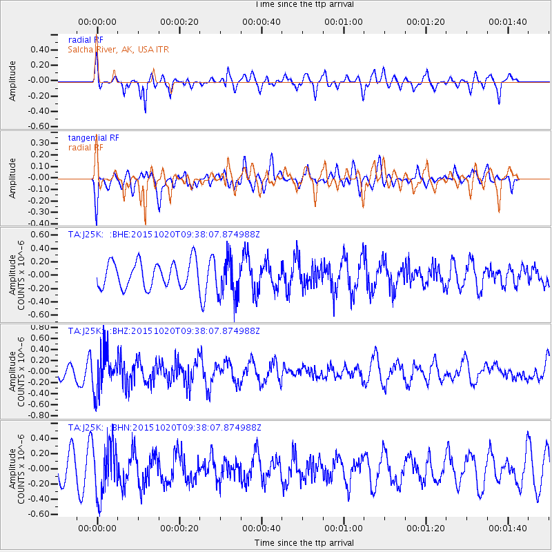
J25K Salcha River, AK, USA - Earthquake Result Viewer
*The percent match for this event was below the threshold and hence no stack was calculated.
| Earthquake location: |
Bonin Islands, Japan Region |
| Earthquake latitude/longitude: |
27.0/140.3 |
| Earthquake time(UTC): |
2015/10/20 (293) 09:29:08 GMT |
| Earthquake Depth: |
300 km |
| Earthquake Magnitude: |
5.5 MB |
| Earthquake Catalog/Contributor: |
NEIC PDE/NEIC COMCAT |
|
| Network: |
TA USArray Transportable Network (new EarthScope stations) |
| Station: |
J25K Salcha River, AK, USA |
| Lat/Lon: |
64.61 N/145.37 W |
| Elevation: |
949 m |
|
| Distance: |
59.2 deg |
| Az: |
28.89 deg |
| Baz: |
268.534 deg |
| Ray Param: |
$rayparam |
*The percent match for this event was below the threshold and hence was not used in the summary stack. |
|
| Radial Match: |
59.01545 % |
| Radial Bump: |
400 |
| Transverse Match: |
29.854286 % |
| Transverse Bump: |
400 |
| SOD ConfigId: |
7422571 |
| Insert Time: |
2019-04-21 04:05:03.846 +0000 |
| GWidth: |
2.5 |
| Max Bumps: |
400 |
| Tol: |
0.001 |
|
Signal To Noise
| Channel | StoN | STA | LTA |
| TA:J25K: :BHZ:20151020T09:38:07.874988Z | 2.1267881 | 3.7432716E-7 | 1.7600584E-7 |
| TA:J25K: :BHN:20151020T09:38:07.874988Z | 2.1202738 | 3.4238747E-7 | 1.6148266E-7 |
| TA:J25K: :BHE:20151020T09:38:07.874988Z | 1.500018 | 2.8681345E-7 | 1.9120667E-7 |
| Arrivals |
| Ps | |
| PpPs | |
| PsPs/PpSs | |


