You are here: Home > Network List > TA - USArray Transportable Network (new EarthScope stations) Stations List
> Station L19K White Mountain, AK, USA > Earthquake Result Viewer
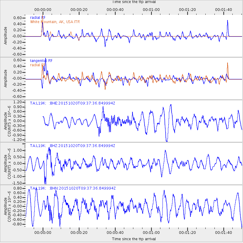
L19K White Mountain, AK, USA - Earthquake Result Viewer
*The percent match for this event was below the threshold and hence no stack was calculated.
| Earthquake location: |
Bonin Islands, Japan Region |
| Earthquake latitude/longitude: |
27.0/140.3 |
| Earthquake time(UTC): |
2015/10/20 (293) 09:29:08 GMT |
| Earthquake Depth: |
300 km |
| Earthquake Magnitude: |
5.5 MB |
| Earthquake Catalog/Contributor: |
NEIC PDE/NEIC COMCAT |
|
| Network: |
TA USArray Transportable Network (new EarthScope stations) |
| Station: |
L19K White Mountain, AK, USA |
| Lat/Lon: |
62.18 N/154.85 W |
| Elevation: |
650 m |
|
| Distance: |
54.8 deg |
| Az: |
31.333 deg |
| Baz: |
261.391 deg |
| Ray Param: |
$rayparam |
*The percent match for this event was below the threshold and hence was not used in the summary stack. |
|
| Radial Match: |
51.396248 % |
| Radial Bump: |
400 |
| Transverse Match: |
68.93813 % |
| Transverse Bump: |
400 |
| SOD ConfigId: |
7422571 |
| Insert Time: |
2019-04-21 04:05:10.772 +0000 |
| GWidth: |
2.5 |
| Max Bumps: |
400 |
| Tol: |
0.001 |
|
Signal To Noise
| Channel | StoN | STA | LTA |
| TA:L19K: :BHZ:20151020T09:37:36.849994Z | 3.2114015 | 7.8436165E-7 | 2.4424278E-7 |
| TA:L19K: :BHN:20151020T09:37:36.849994Z | 0.7226935 | 2.6871356E-7 | 3.718223E-7 |
| TA:L19K: :BHE:20151020T09:37:36.849994Z | 2.1452436 | 4.4556634E-7 | 2.0769964E-7 |
| Arrivals |
| Ps | |
| PpPs | |
| PsPs/PpSs | |


