You are here: Home > Network List > TA - USArray Transportable Network (new EarthScope stations) Stations List
> Station O03E Paynes Creek, CA, USA > Earthquake Result Viewer
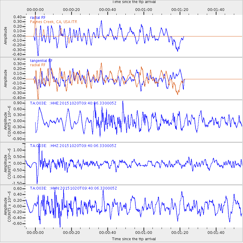
O03E Paynes Creek, CA, USA - Earthquake Result Viewer
*The percent match for this event was below the threshold and hence no stack was calculated.
| Earthquake location: |
Bonin Islands, Japan Region |
| Earthquake latitude/longitude: |
27.0/140.3 |
| Earthquake time(UTC): |
2015/10/20 (293) 09:29:08 GMT |
| Earthquake Depth: |
300 km |
| Earthquake Magnitude: |
5.5 MB |
| Earthquake Catalog/Contributor: |
NEIC PDE/NEIC COMCAT |
|
| Network: |
TA USArray Transportable Network (new EarthScope stations) |
| Station: |
O03E Paynes Creek, CA, USA |
| Lat/Lon: |
40.29 N/121.80 W |
| Elevation: |
967 m |
|
| Distance: |
78.6 deg |
| Az: |
50.596 deg |
| Baz: |
295.697 deg |
| Ray Param: |
$rayparam |
*The percent match for this event was below the threshold and hence was not used in the summary stack. |
|
| Radial Match: |
56.536114 % |
| Radial Bump: |
400 |
| Transverse Match: |
55.384537 % |
| Transverse Bump: |
382 |
| SOD ConfigId: |
7422571 |
| Insert Time: |
2019-04-21 04:05:21.975 +0000 |
| GWidth: |
2.5 |
| Max Bumps: |
400 |
| Tol: |
0.001 |
|
Signal To Noise
| Channel | StoN | STA | LTA |
| TA:O03E: :HHZ:20151020T09:40:06.330005Z | 4.336222 | 6.3532764E-7 | 1.4651638E-7 |
| TA:O03E: :HHN:20151020T09:40:06.330005Z | 1.3504834 | 2.453407E-7 | 1.8166878E-7 |
| TA:O03E: :HHE:20151020T09:40:06.330005Z | 1.2307645 | 3.499002E-7 | 2.8429503E-7 |
| Arrivals |
| Ps | |
| PpPs | |
| PsPs/PpSs | |


