You are here: Home > Network List > TA - USArray Transportable Network (new EarthScope stations) Stations List
> Station S22A 4UR Ranch, Creede, CO, USA > Earthquake Result Viewer
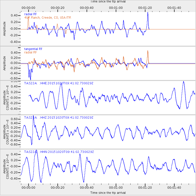
S22A 4UR Ranch, Creede, CO, USA - Earthquake Result Viewer
*The percent match for this event was below the threshold and hence no stack was calculated.
| Earthquake location: |
Bonin Islands, Japan Region |
| Earthquake latitude/longitude: |
27.0/140.3 |
| Earthquake time(UTC): |
2015/10/20 (293) 09:29:08 GMT |
| Earthquake Depth: |
300 km |
| Earthquake Magnitude: |
5.5 MB |
| Earthquake Catalog/Contributor: |
NEIC PDE/NEIC COMCAT |
|
| Network: |
TA USArray Transportable Network (new EarthScope stations) |
| Station: |
S22A 4UR Ranch, Creede, CO, USA |
| Lat/Lon: |
37.75 N/106.83 W |
| Elevation: |
2626 m |
|
| Distance: |
90.0 deg |
| Az: |
46.903 deg |
| Baz: |
304.752 deg |
| Ray Param: |
$rayparam |
*The percent match for this event was below the threshold and hence was not used in the summary stack. |
|
| Radial Match: |
55.149117 % |
| Radial Bump: |
400 |
| Transverse Match: |
63.047234 % |
| Transverse Bump: |
330 |
| SOD ConfigId: |
7422571 |
| Insert Time: |
2019-04-21 04:05:27.027 +0000 |
| GWidth: |
2.5 |
| Max Bumps: |
400 |
| Tol: |
0.001 |
|
Signal To Noise
| Channel | StoN | STA | LTA |
| TA:S22A: :HHZ:20151020T09:41:02.730029Z | 3.1097746 | 3.6081573E-7 | 1.1602633E-7 |
| TA:S22A: :HHN:20151020T09:41:02.730029Z | 2.1760223 | 3.2045133E-7 | 1.4726473E-7 |
| TA:S22A: :HHE:20151020T09:41:02.730029Z | 0.51523316 | 1.1500333E-7 | 2.2320638E-7 |
| Arrivals |
| Ps | |
| PpPs | |
| PsPs/PpSs | |


