You are here: Home > Network List > TA - USArray Transportable Network (new EarthScope stations) Stations List
> Station T25A Trinidad, CO, USA > Earthquake Result Viewer
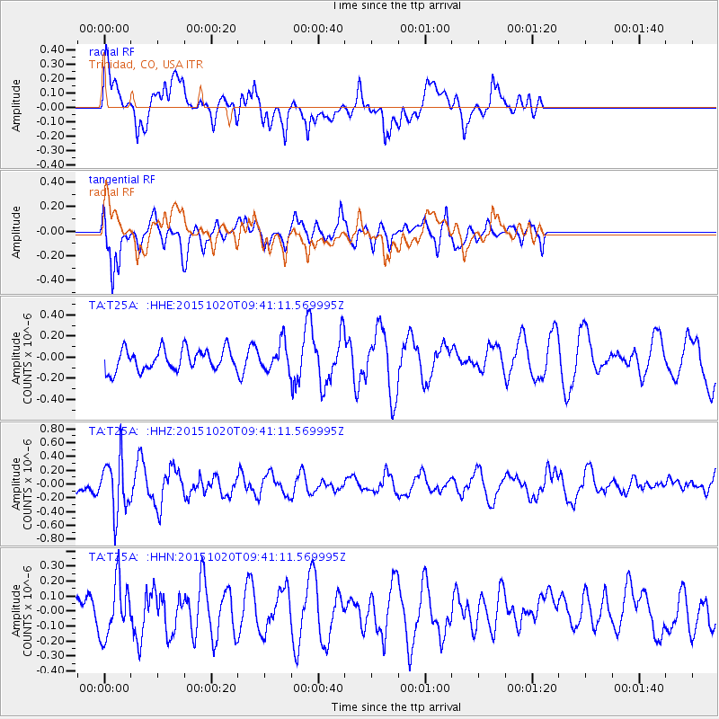
T25A Trinidad, CO, USA - Earthquake Result Viewer
*The percent match for this event was below the threshold and hence no stack was calculated.
| Earthquake location: |
Bonin Islands, Japan Region |
| Earthquake latitude/longitude: |
27.0/140.3 |
| Earthquake time(UTC): |
2015/10/20 (293) 09:29:08 GMT |
| Earthquake Depth: |
300 km |
| Earthquake Magnitude: |
5.5 MB |
| Earthquake Catalog/Contributor: |
NEIC PDE/NEIC COMCAT |
|
| Network: |
TA USArray Transportable Network (new EarthScope stations) |
| Station: |
T25A Trinidad, CO, USA |
| Lat/Lon: |
37.14 N/104.41 W |
| Elevation: |
2017 m |
|
| Distance: |
91.9 deg |
| Az: |
46.279 deg |
| Baz: |
306.227 deg |
| Ray Param: |
$rayparam |
*The percent match for this event was below the threshold and hence was not used in the summary stack. |
|
| Radial Match: |
47.990314 % |
| Radial Bump: |
400 |
| Transverse Match: |
52.182884 % |
| Transverse Bump: |
400 |
| SOD ConfigId: |
7422571 |
| Insert Time: |
2019-04-21 04:05:28.377 +0000 |
| GWidth: |
2.5 |
| Max Bumps: |
400 |
| Tol: |
0.001 |
|
Signal To Noise
| Channel | StoN | STA | LTA |
| TA:T25A: :HHZ:20151020T09:41:11.569995Z | 3.525977 | 3.9413473E-7 | 1.11780295E-7 |
| TA:T25A: :HHN:20151020T09:41:11.569995Z | 1.642012 | 1.8399675E-7 | 1.12055666E-7 |
| TA:T25A: :HHE:20151020T09:41:11.569995Z | 1.3564342 | 1.3717336E-7 | 1.0112791E-7 |
| Arrivals |
| Ps | |
| PpPs | |
| PsPs/PpSs | |


