You are here: Home > Network List > TJ - Tajikistan National Seismic Network Stations List
> Station GARM Garm, Tajikistan > Earthquake Result Viewer
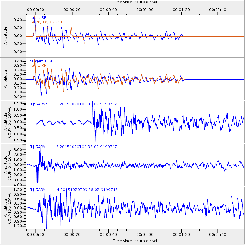
GARM Garm, Tajikistan - Earthquake Result Viewer
*The percent match for this event was below the threshold and hence no stack was calculated.
| Earthquake location: |
Bonin Islands, Japan Region |
| Earthquake latitude/longitude: |
27.0/140.3 |
| Earthquake time(UTC): |
2015/10/20 (293) 09:29:08 GMT |
| Earthquake Depth: |
300 km |
| Earthquake Magnitude: |
5.5 MB |
| Earthquake Catalog/Contributor: |
NEIC PDE/NEIC COMCAT |
|
| Network: |
TJ Tajikistan National Seismic Network |
| Station: |
GARM Garm, Tajikistan |
| Lat/Lon: |
39.00 N/70.32 E |
| Elevation: |
1305 m |
|
| Distance: |
58.6 deg |
| Az: |
300.911 deg |
| Baz: |
79.152 deg |
| Ray Param: |
$rayparam |
*The percent match for this event was below the threshold and hence was not used in the summary stack. |
|
| Radial Match: |
71.252846 % |
| Radial Bump: |
400 |
| Transverse Match: |
71.008095 % |
| Transverse Bump: |
400 |
| SOD ConfigId: |
7422571 |
| Insert Time: |
2019-04-21 04:05:37.787 +0000 |
| GWidth: |
2.5 |
| Max Bumps: |
400 |
| Tol: |
0.001 |
|
Signal To Noise
| Channel | StoN | STA | LTA |
| TJ:GARM: :HHZ:20151020T09:38:02.919971Z | 16.742292 | 1.5184914E-6 | 9.069793E-8 |
| TJ:GARM: :HHN:20151020T09:38:02.919971Z | 2.7600784 | 3.7085334E-7 | 1.3436335E-7 |
| TJ:GARM: :HHE:20151020T09:38:02.919971Z | 6.335292 | 6.717334E-7 | 1.06030384E-7 |
| Arrivals |
| Ps | |
| PpPs | |
| PsPs/PpSs | |


