You are here: Home > Network List > UW - Pacific Northwest Regional Seismic Network Stations List
> Station MRBL Marblemount, WA, USA > Earthquake Result Viewer
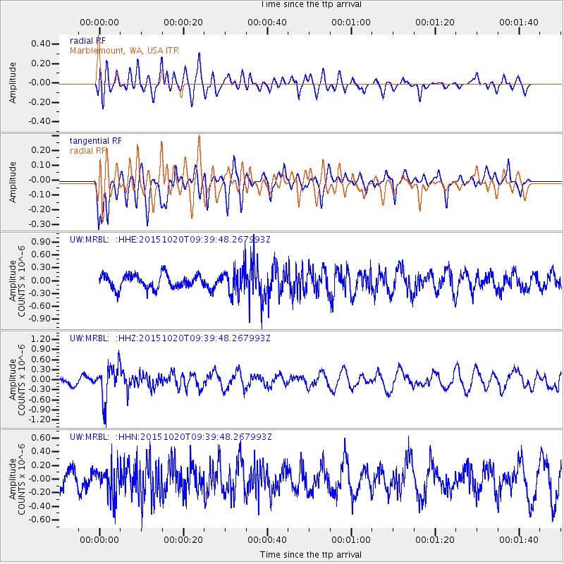
MRBL Marblemount, WA, USA - Earthquake Result Viewer
*The percent match for this event was below the threshold and hence no stack was calculated.
| Earthquake location: |
Bonin Islands, Japan Region |
| Earthquake latitude/longitude: |
27.0/140.3 |
| Earthquake time(UTC): |
2015/10/20 (293) 09:29:08 GMT |
| Earthquake Depth: |
300 km |
| Earthquake Magnitude: |
5.5 MB |
| Earthquake Catalog/Contributor: |
NEIC PDE/NEIC COMCAT |
|
| Network: |
UW Pacific Northwest Regional Seismic Network |
| Station: |
MRBL Marblemount, WA, USA |
| Lat/Lon: |
48.52 N/121.48 W |
| Elevation: |
75 m |
|
| Distance: |
75.4 deg |
| Az: |
42.846 deg |
| Baz: |
294.173 deg |
| Ray Param: |
$rayparam |
*The percent match for this event was below the threshold and hence was not used in the summary stack. |
|
| Radial Match: |
55.454727 % |
| Radial Bump: |
400 |
| Transverse Match: |
59.944473 % |
| Transverse Bump: |
400 |
| SOD ConfigId: |
7422571 |
| Insert Time: |
2019-04-21 04:06:11.497 +0000 |
| GWidth: |
2.5 |
| Max Bumps: |
400 |
| Tol: |
0.001 |
|
Signal To Noise
| Channel | StoN | STA | LTA |
| UW:MRBL: :HHZ:20151020T09:39:48.267993Z | 4.985914 | 5.130137E-7 | 1.0289259E-7 |
| UW:MRBL: :HHN:20151020T09:39:48.267993Z | 1.4148866 | 2.1355996E-7 | 1.5093786E-7 |
| UW:MRBL: :HHE:20151020T09:39:48.267993Z | 1.9651896 | 3.0879502E-7 | 1.5713243E-7 |
| Arrivals |
| Ps | |
| PpPs | |
| PsPs/PpSs | |


