
BJT Baijiatuan, Beijing, China - Earthquake Result Viewer
| ||||||||||||||||||
| ||||||||||||||||||
| ||||||||||||||||||
|
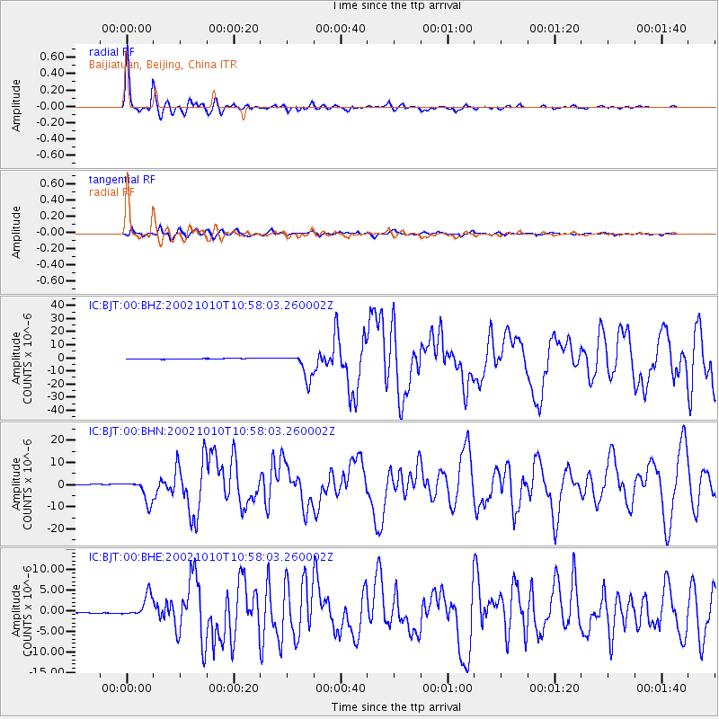
Signal To Noise
| Channel | StoN | STA | LTA |
| IC:BJT:00:BHN:20021010T10:58:03.260002Z | 24.838522 | 5.12821E-6 | 2.0646198E-7 |
| IC:BJT:00:BHE:20021010T10:58:03.260002Z | 18.914389 | 2.6648077E-6 | 1.4088786E-7 |
| IC:BJT:00:BHZ:20021010T10:58:03.260002Z | 33.285706 | 9.962129E-6 | 2.992915E-7 |
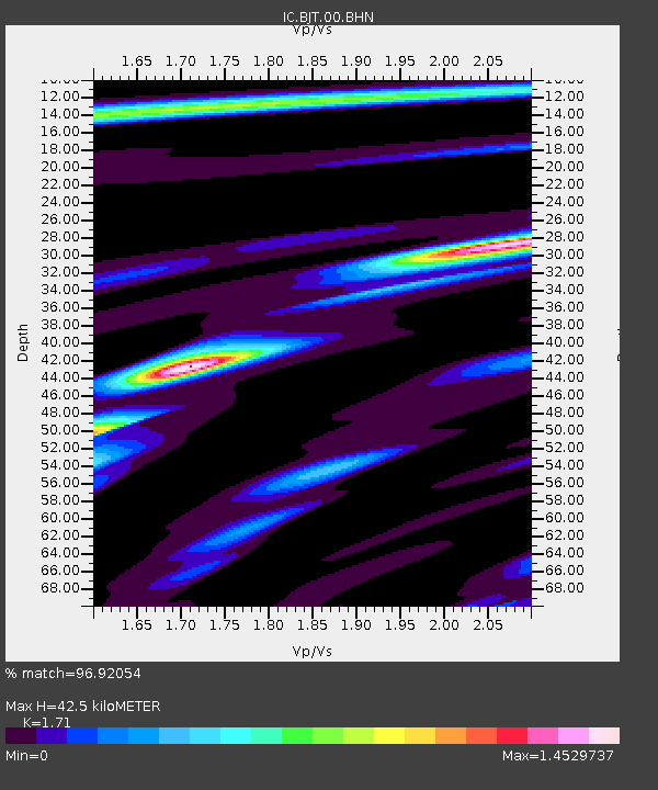
| Arrivals | |
| Ps | 5.0 SECOND |
| PpPs | 17 SECOND |
| PsPs/PpSs | 22 SECOND |

