
BJT Baijiatuan, Beijing, China - Earthquake Result Viewer
| ||||||||||||||||||
| ||||||||||||||||||
| ||||||||||||||||||
|
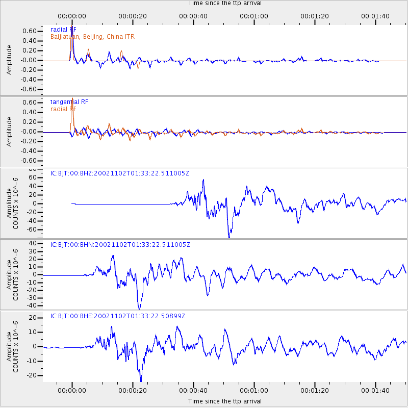
Signal To Noise
| Channel | StoN | STA | LTA |
| IC:BJT:00:BHN:20021102T01:33:22.511005Z | 1.3649237 | 3.8124614E-7 | 2.793168E-7 |
| IC:BJT:00:BHE:20021102T01:33:22.50899Z | 1.1132712 | 2.3073284E-7 | 2.0725662E-7 |
| IC:BJT:00:BHZ:20021102T01:33:22.511005Z | 3.2767477 | 1.0004728E-6 | 3.0532496E-7 |
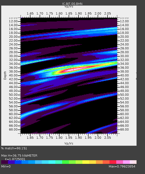
| Arrivals | |
| Ps | 5.3 SECOND |
| PpPs | 15 SECOND |
| PsPs/PpSs | 21 SECOND |

