
BJT Baijiatuan, Beijing, China - Earthquake Result Viewer
| ||||||||||||||||||
| ||||||||||||||||||
| ||||||||||||||||||
|
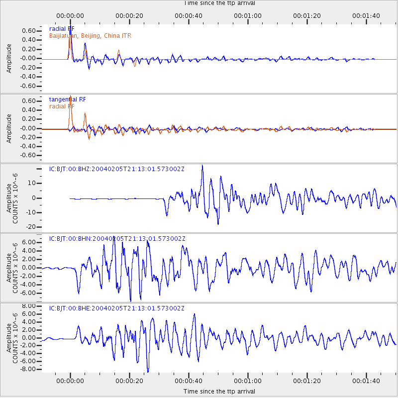
Signal To Noise
| Channel | StoN | STA | LTA |
| IC:BJT:00:BHN:20040205T21:13:01.573002Z | 18.68916 | 2.152063E-6 | 1.1515033E-7 |
| IC:BJT:00:BHE:20040205T21:13:01.573002Z | 6.1284776 | 1.2291049E-6 | 2.0055631E-7 |
| IC:BJT:00:BHZ:20040205T21:13:01.573002Z | 33.982265 | 4.135992E-6 | 1.2171033E-7 |
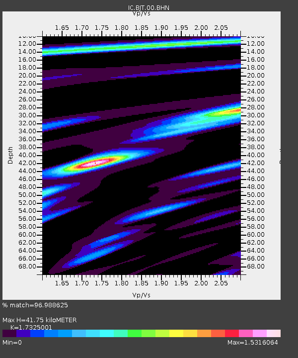
| Arrivals | |
| Ps | 5.0 SECOND |
| PpPs | 17 SECOND |
| PsPs/PpSs | 22 SECOND |

