
BJT Baijiatuan, Beijing, China - Earthquake Result Viewer
| ||||||||||||||||||
| ||||||||||||||||||
| ||||||||||||||||||
|
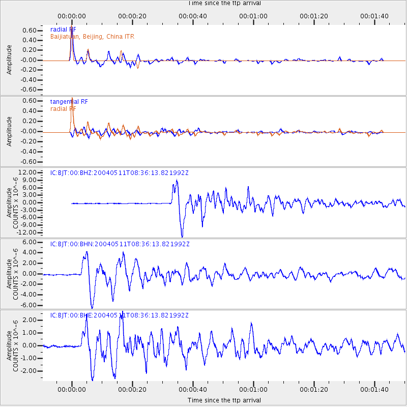
Signal To Noise
| Channel | StoN | STA | LTA |
| IC:BJT:00:BHN:20040511T08:36:13.821992Z | 35.903316 | 1.7016474E-6 | 4.7395268E-8 |
| IC:BJT:00:BHE:20040511T08:36:13.821992Z | 18.12154 | 7.6796897E-7 | 4.237879E-8 |
| IC:BJT:00:BHZ:20040511T08:36:13.821992Z | 64.672646 | 3.6936349E-6 | 5.7112782E-8 |
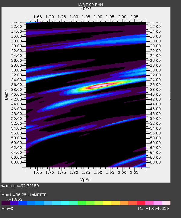
| Arrivals | |
| Ps | 5.4 SECOND |
| PpPs | 15 SECOND |
| PsPs/PpSs | 21 SECOND |

