You are here: Home > Network List > AV - Alaska Volcano Observatory Stations List
> Station MAPS Pakushin Southeast, Makushin Volcano, Alaska > Earthquake Result Viewer
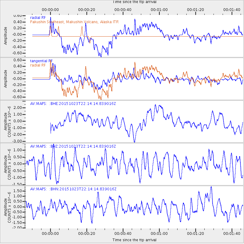
MAPS Pakushin Southeast, Makushin Volcano, Alaska - Earthquake Result Viewer
*The percent match for this event was below the threshold and hence no stack was calculated.
| Earthquake location: |
Irian Jaya, Indonesia |
| Earthquake latitude/longitude: |
-2.1/138.2 |
| Earthquake time(UTC): |
2015/10/23 (296) 22:03:22 GMT |
| Earthquake Depth: |
10 km |
| Earthquake Magnitude: |
5.7 MWB |
| Earthquake Catalog/Contributor: |
NEIC PDE/NEIC COMCAT |
|
| Network: |
AV Alaska Volcano Observatory |
| Station: |
MAPS Pakushin Southeast, Makushin Volcano, Alaska |
| Lat/Lon: |
53.81 N/166.94 W |
| Elevation: |
333 m |
|
| Distance: |
71.9 deg |
| Az: |
30.684 deg |
| Baz: |
239.299 deg |
| Ray Param: |
$rayparam |
*The percent match for this event was below the threshold and hence was not used in the summary stack. |
|
| Radial Match: |
59.94192 % |
| Radial Bump: |
400 |
| Transverse Match: |
57.703598 % |
| Transverse Bump: |
400 |
| SOD ConfigId: |
7422571 |
| Insert Time: |
2019-04-21 04:39:09.677 +0000 |
| GWidth: |
2.5 |
| Max Bumps: |
400 |
| Tol: |
0.001 |
|
Signal To Noise
| Channel | StoN | STA | LTA |
| AV:MAPS: :BHZ:20151023T22:14:14.839016Z | 2.4818053 | 9.917063E-7 | 3.995907E-7 |
| AV:MAPS: :BHN:20151023T22:14:14.839016Z | 0.57250965 | 3.275706E-7 | 5.721661E-7 |
| AV:MAPS: :BHE:20151023T22:14:14.839016Z | 0.90153104 | 6.993295E-7 | 7.757132E-7 |
| Arrivals |
| Ps | |
| PpPs | |
| PsPs/PpSs | |


