
BJT Baijiatuan, Beijing, China - Earthquake Result Viewer
| ||||||||||||||||||
| ||||||||||||||||||
| ||||||||||||||||||
|
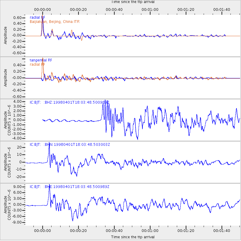
Signal To Noise
| Channel | StoN | STA | LTA |
| IC:BJT: :BHN:19980401T18:03:48.503003Z | 42.907593 | 8.034917E-6 | 1.8726097E-7 |
| IC:BJT: :BHE:19980401T18:03:48.500989Z | 16.179482 | 3.3495937E-6 | 2.0702726E-7 |
| IC:BJT: :BHZ:19980401T18:03:48.500989Z | 8.80655 | 1.2474084E-6 | 1.4164553E-7 |
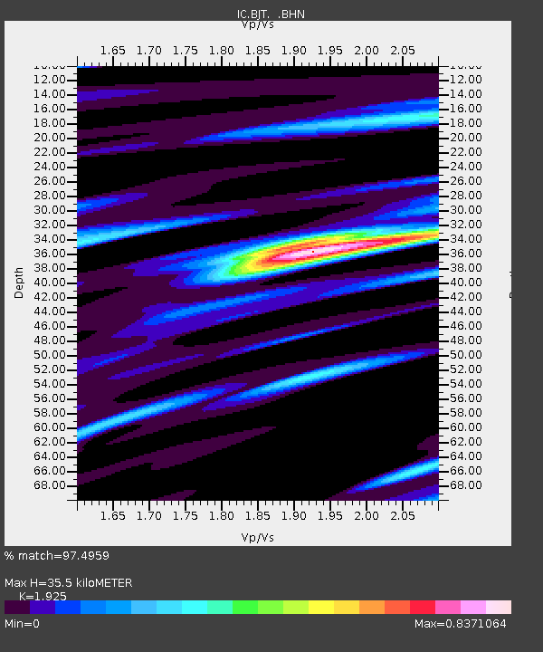
| Arrivals | |
| Ps | 5.4 SECOND |
| PpPs | 15 SECOND |
| PsPs/PpSs | 21 SECOND |

