
BJT Baijiatuan, Beijing, China - Earthquake Result Viewer
| ||||||||||||||||||
| ||||||||||||||||||
| ||||||||||||||||||
|
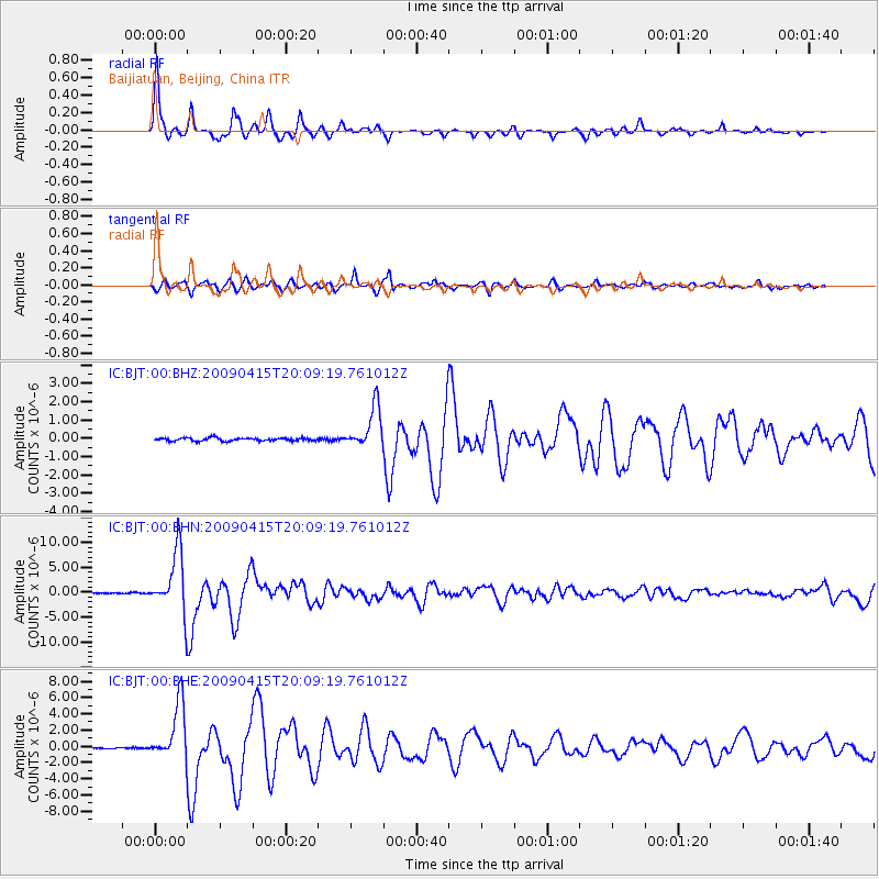
Signal To Noise
| Channel | StoN | STA | LTA |
| IC:BJT:00:BHN:20090415T20:09:19.761012Z | 54.118828 | 6.114085E-6 | 1.12975194E-7 |
| IC:BJT:00:BHE:20090415T20:09:19.761012Z | 49.09609 | 3.4991658E-6 | 7.1271785E-8 |
| IC:BJT:00:BHZ:20090415T20:09:19.761012Z | 13.849043 | 1.1255311E-6 | 8.1271395E-8 |
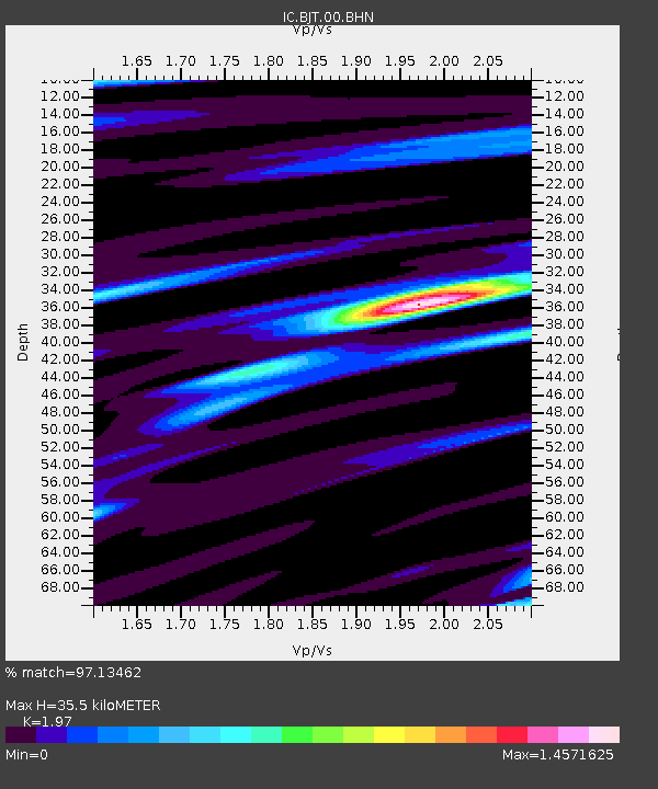
| Arrivals | |
| Ps | 5.6 SECOND |
| PpPs | 15 SECOND |
| PsPs/PpSs | 21 SECOND |

