
BJT Baijiatuan, Beijing, China - Earthquake Result Viewer
| ||||||||||||||||||
| ||||||||||||||||||
| ||||||||||||||||||
|
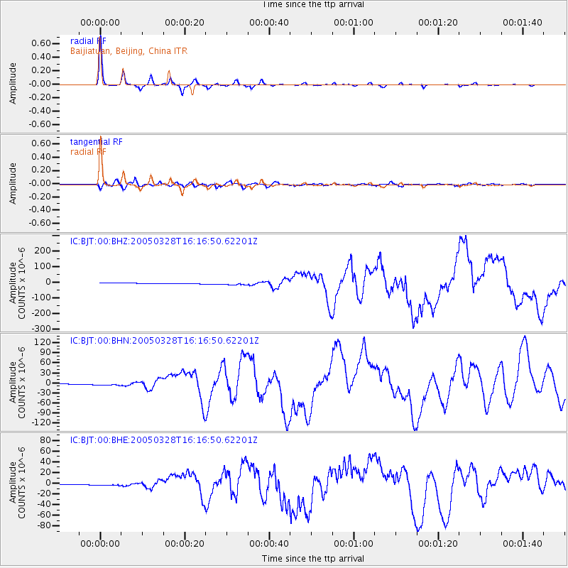
Signal To Noise
| Channel | StoN | STA | LTA |
| IC:BJT:00:BHN:20050328T16:16:50.62201Z | 5.2167854 | 4.4866633E-6 | 8.600437E-7 |
| IC:BJT:00:BHE:20050328T16:16:50.62201Z | 5.2140827 | 2.6503615E-6 | 5.083083E-7 |
| IC:BJT:00:BHZ:20050328T16:16:50.62201Z | 4.263433 | 7.861643E-6 | 1.84397E-6 |
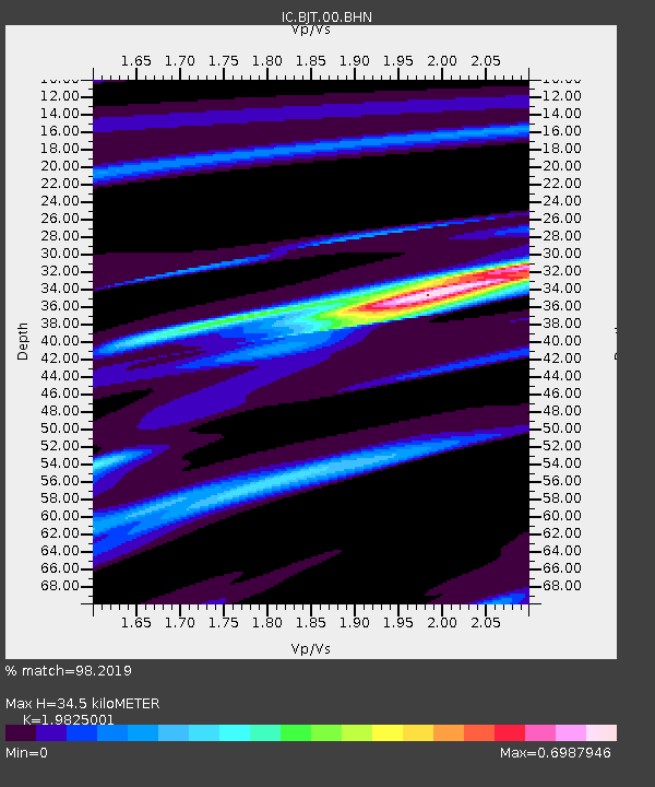
| Arrivals | |
| Ps | 5.6 SECOND |
| PpPs | 15 SECOND |
| PsPs/PpSs | 21 SECOND |

