
BJT Baijiatuan, Beijing, China - Earthquake Result Viewer
| ||||||||||||||||||
| ||||||||||||||||||
| ||||||||||||||||||
|
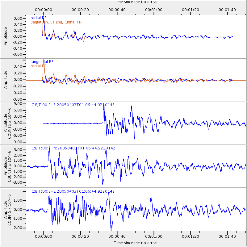
Signal To Noise
| Channel | StoN | STA | LTA |
| IC:BJT:00:BHN:20050403T01:06:44.922014Z | 9.913664 | 1.3420719E-6 | 1.3537597E-7 |
| IC:BJT:00:BHE:20050403T01:06:44.922014Z | 11.711395 | 7.547281E-7 | 6.444391E-8 |
| IC:BJT:00:BHZ:20050403T01:06:44.922014Z | 34.179947 | 3.1389227E-6 | 9.183521E-8 |
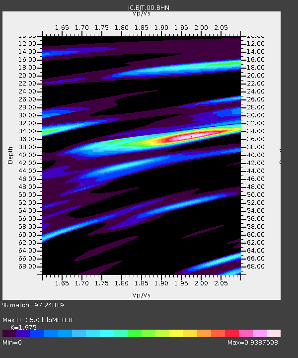
| Arrivals | |
| Ps | 5.6 SECOND |
| PpPs | 15 SECOND |
| PsPs/PpSs | 21 SECOND |

