
BJT Baijiatuan, Beijing, China - Earthquake Result Viewer
| ||||||||||||||||||
| ||||||||||||||||||
| ||||||||||||||||||
|
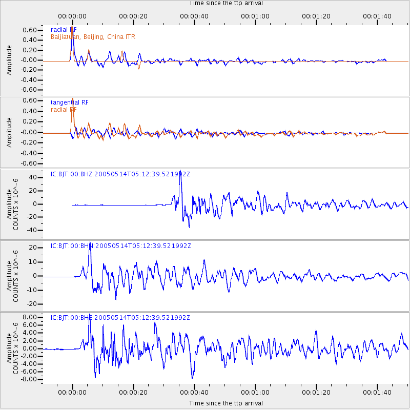
Signal To Noise
| Channel | StoN | STA | LTA |
| IC:BJT:00:BHN:20050514T05:12:39.521992Z | 37.959106 | 2.2334812E-6 | 5.8839138E-8 |
| IC:BJT:00:BHE:20050514T05:12:39.521992Z | 23.614437 | 9.4643053E-7 | 4.0078472E-8 |
| IC:BJT:00:BHZ:20050514T05:12:39.521992Z | 82.67381 | 5.1515403E-6 | 6.231163E-8 |
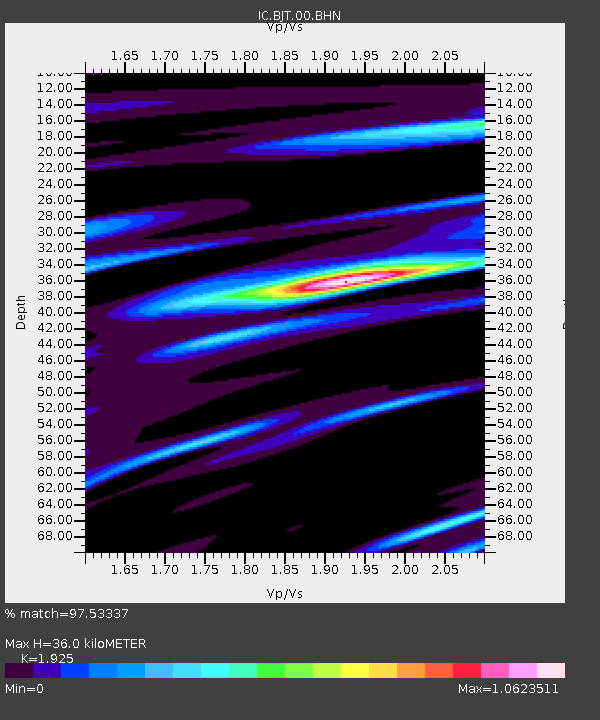
| Arrivals | |
| Ps | 5.5 SECOND |
| PpPs | 15 SECOND |
| PsPs/PpSs | 21 SECOND |

