You are here: Home > Network List > LD - Lamont-Doherty Cooperative Seismographic Network Stations List
> Station TUPA Temple University, Pennsylvania > Earthquake Result Viewer
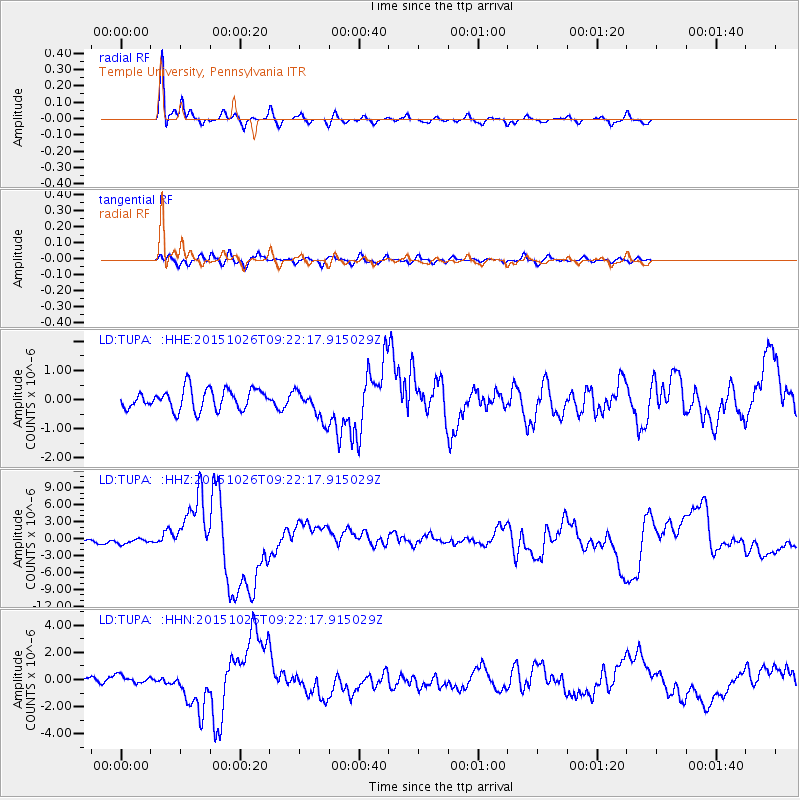
TUPA Temple University, Pennsylvania - Earthquake Result Viewer
*The percent match for this event was below the threshold and hence no stack was calculated.
| Earthquake location: |
Hindu Kush Region, Afghanistan |
| Earthquake latitude/longitude: |
36.4/70.7 |
| Earthquake time(UTC): |
2015/10/26 (299) 09:09:32 GMT |
| Earthquake Depth: |
212 km |
| Earthquake Magnitude: |
7.5 MWW, 7.5 MWB |
| Earthquake Catalog/Contributor: |
NEIC PDE/NEIC COMCAT |
|
| Network: |
LD Lamont-Doherty Cooperative Seismographic Network |
| Station: |
TUPA Temple University, Pennsylvania |
| Lat/Lon: |
40.17 N/75.19 W |
| Elevation: |
112 m |
|
| Distance: |
97.6 deg |
| Az: |
334.319 deg |
| Baz: |
27.131 deg |
| Ray Param: |
$rayparam |
*The percent match for this event was below the threshold and hence was not used in the summary stack. |
|
| Radial Match: |
95.89316 % |
| Radial Bump: |
298 |
| Transverse Match: |
68.67186 % |
| Transverse Bump: |
400 |
| SOD ConfigId: |
7422571 |
| Insert Time: |
2019-04-21 05:05:50.410 +0000 |
| GWidth: |
2.5 |
| Max Bumps: |
400 |
| Tol: |
0.001 |
|
Signal To Noise
| Channel | StoN | STA | LTA |
| LD:TUPA: :HHZ:20151026T09:22:17.915029Z | 1.1339831 | 4.4291883E-7 | 3.905868E-7 |
| LD:TUPA: :HHN:20151026T09:22:17.915029Z | 1.4825374 | 2.8990272E-7 | 1.9554496E-7 |
| LD:TUPA: :HHE:20151026T09:22:17.915029Z | 0.8123923 | 2.93223E-7 | 3.609377E-7 |
| Arrivals |
| Ps | |
| PpPs | |
| PsPs/PpSs | |


