
BJT Baijiatuan, Beijing, China - Earthquake Result Viewer
| ||||||||||||||||||
| ||||||||||||||||||
| ||||||||||||||||||
|
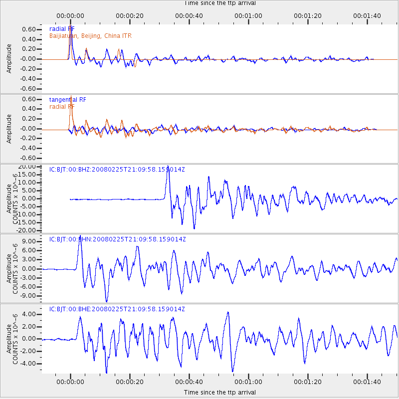
Signal To Noise
| Channel | StoN | STA | LTA |
| IC:BJT:00:BHN:20080225T21:09:58.159014Z | 47.326736 | 4.656122E-6 | 9.838249E-8 |
| IC:BJT:00:BHE:20080225T21:09:58.159014Z | 14.410463 | 1.5720024E-6 | 1.0908756E-7 |
| IC:BJT:00:BHZ:20080225T21:09:58.159014Z | 66.39665 | 8.720578E-6 | 1.3134063E-7 |
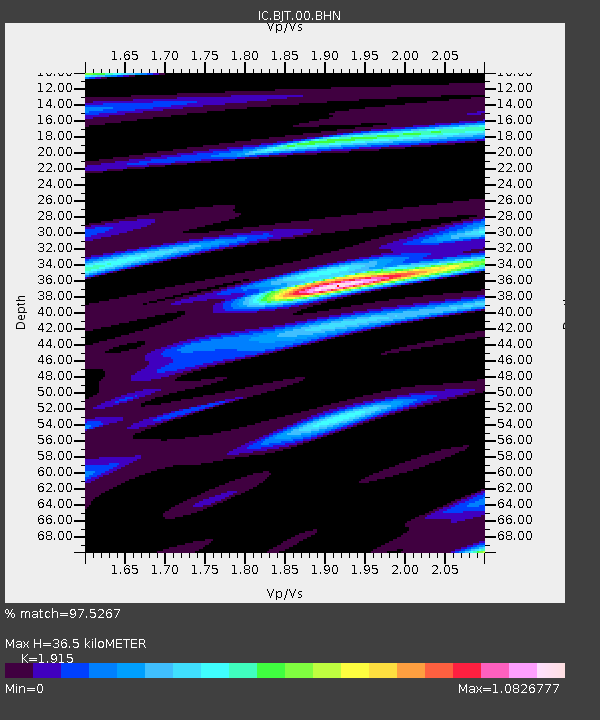
| Arrivals | |
| Ps | 5.5 SECOND |
| PpPs | 15 SECOND |
| PsPs/PpSs | 21 SECOND |

