
BJT Baijiatuan, Beijing, China - Earthquake Result Viewer
| ||||||||||||||||||
| ||||||||||||||||||
| ||||||||||||||||||
|
Signal To Noise
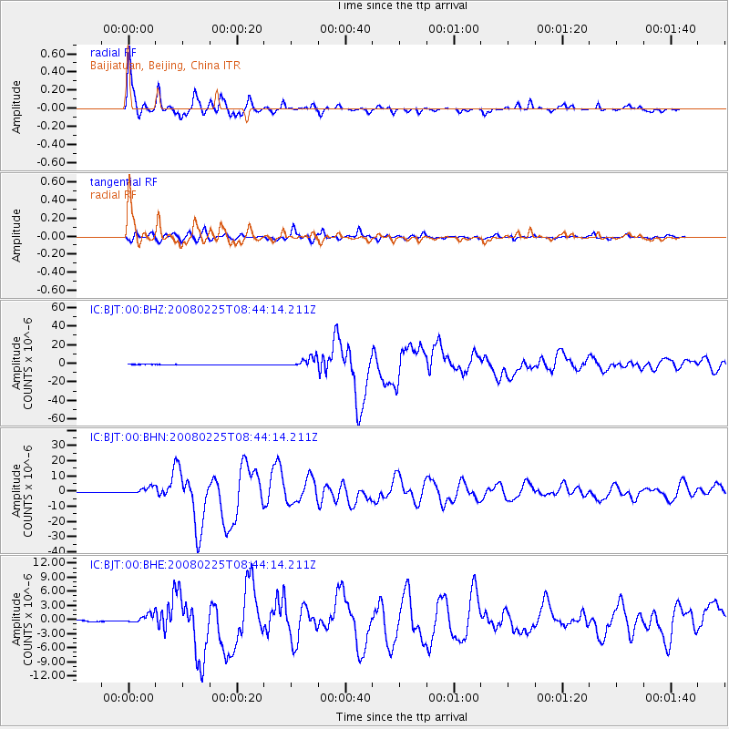
| Channel | StoN | STA | LTA |
| IC:BJT:00:BHN:20080225T08:44:14.211Z | 19.456848 | 2.4220178E-6 | 1.244815E-7 |
| IC:BJT:00:BHE:20080225T08:44:14.211Z | 7.208963 | 9.895488E-7 | 1.3726645E-7 |
| IC:BJT:00:BHZ:20080225T08:44:14.211Z | 29.557621 | 5.506207E-6 | 1.8628721E-7 |
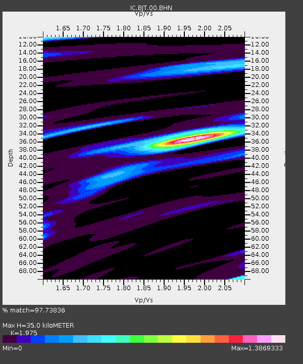
| Arrivals | |
| Ps | 5.6 SECOND |
| PpPs | 15 SECOND |
| PsPs/PpSs | 21 SECOND |

