You are here: Home > Network List > US - United States National Seismic Network Stations List
> Station EGMT Eagleton, Montana, USA > Earthquake Result Viewer
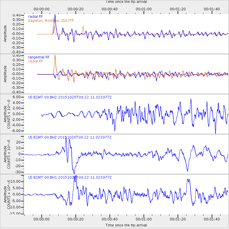
EGMT Eagleton, Montana, USA - Earthquake Result Viewer
*The percent match for this event was below the threshold and hence no stack was calculated.
| Earthquake location: |
Hindu Kush Region, Afghanistan |
| Earthquake latitude/longitude: |
36.4/70.7 |
| Earthquake time(UTC): |
2015/10/26 (299) 09:09:32 GMT |
| Earthquake Depth: |
212 km |
| Earthquake Magnitude: |
7.5 MWW, 7.5 MWB |
| Earthquake Catalog/Contributor: |
NEIC PDE/NEIC COMCAT |
|
| Network: |
US United States National Seismic Network |
| Station: |
EGMT Eagleton, Montana, USA |
| Lat/Lon: |
48.02 N/109.75 W |
| Elevation: |
1055 m |
|
| Distance: |
95.9 deg |
| Az: |
0.318 deg |
| Baz: |
359.618 deg |
| Ray Param: |
$rayparam |
*The percent match for this event was below the threshold and hence was not used in the summary stack. |
|
| Radial Match: |
92.60056 % |
| Radial Bump: |
400 |
| Transverse Match: |
77.49943 % |
| Transverse Bump: |
400 |
| SOD ConfigId: |
7422571 |
| Insert Time: |
2019-04-21 05:07:36.088 +0000 |
| GWidth: |
2.5 |
| Max Bumps: |
400 |
| Tol: |
0.001 |
|
Signal To Noise
| Channel | StoN | STA | LTA |
| US:EGMT:00:BHZ:20151026T09:22:11.023977Z | 2.064037 | 7.15178E-7 | 3.4649472E-7 |
| US:EGMT:00:BH1:20151026T09:22:11.023977Z | 0.9920162 | 3.436978E-7 | 3.464639E-7 |
| US:EGMT:00:BH2:20151026T09:22:11.023977Z | 1.3289523 | 7.513919E-7 | 5.654017E-7 |
| Arrivals |
| Ps | |
| PpPs | |
| PsPs/PpSs | |


