You are here: Home > Network List > CI - Caltech Regional Seismic Network Stations List
> Station LRL Laurel Mtn Radio Fac, Ridgecrest, CA, USA > Earthquake Result Viewer
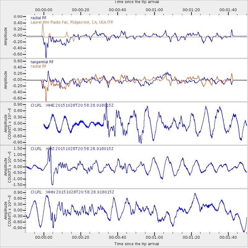
LRL Laurel Mtn Radio Fac, Ridgecrest, CA, USA - Earthquake Result Viewer
*The percent match for this event was below the threshold and hence no stack was calculated.
| Earthquake location: |
Santa Cruz Islands |
| Earthquake latitude/longitude: |
-11.0/166.4 |
| Earthquake time(UTC): |
2015/10/28 (301) 20:46:41 GMT |
| Earthquake Depth: |
152 km |
| Earthquake Magnitude: |
5.8 MWB |
| Earthquake Catalog/Contributor: |
NEIC PDE/NEIC COMCAT |
|
| Network: |
CI Caltech Regional Seismic Network |
| Station: |
LRL Laurel Mtn Radio Fac, Ridgecrest, CA, USA |
| Lat/Lon: |
35.48 N/117.68 W |
| Elevation: |
1340 m |
|
| Distance: |
85.1 deg |
| Az: |
52.619 deg |
| Baz: |
252.942 deg |
| Ray Param: |
$rayparam |
*The percent match for this event was below the threshold and hence was not used in the summary stack. |
|
| Radial Match: |
55.9868 % |
| Radial Bump: |
400 |
| Transverse Match: |
27.359947 % |
| Transverse Bump: |
400 |
| SOD ConfigId: |
7422571 |
| Insert Time: |
2019-04-21 05:11:15.922 +0000 |
| GWidth: |
2.5 |
| Max Bumps: |
400 |
| Tol: |
0.001 |
|
Signal To Noise
| Channel | StoN | STA | LTA |
| CI:LRL: :HHZ:20151028T20:58:28.918015Z | 4.5982018 | 8.0405044E-7 | 1.7486192E-7 |
| CI:LRL: :HHN:20151028T20:58:28.918015Z | 1.5480633 | 4.8053886E-7 | 3.1041293E-7 |
| CI:LRL: :HHE:20151028T20:58:28.918015Z | 1.5698147 | 3.2506927E-7 | 2.0707493E-7 |
| Arrivals |
| Ps | |
| PpPs | |
| PsPs/PpSs | |


