You are here: Home > Network List > CI - Caltech Regional Seismic Network Stations List
> Station SWS Sam W. Stewart, Westmorland, CA, USA > Earthquake Result Viewer
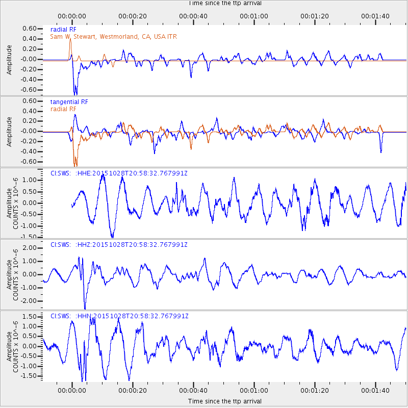
SWS Sam W. Stewart, Westmorland, CA, USA - Earthquake Result Viewer
*The percent match for this event was below the threshold and hence no stack was calculated.
| Earthquake location: |
Santa Cruz Islands |
| Earthquake latitude/longitude: |
-11.0/166.4 |
| Earthquake time(UTC): |
2015/10/28 (301) 20:46:41 GMT |
| Earthquake Depth: |
152 km |
| Earthquake Magnitude: |
5.8 MWB |
| Earthquake Catalog/Contributor: |
NEIC PDE/NEIC COMCAT |
|
| Network: |
CI Caltech Regional Seismic Network |
| Station: |
SWS Sam W. Stewart, Westmorland, CA, USA |
| Lat/Lon: |
32.94 N/115.80 W |
| Elevation: |
140 m |
|
| Distance: |
85.9 deg |
| Az: |
55.498 deg |
| Baz: |
254.224 deg |
| Ray Param: |
$rayparam |
*The percent match for this event was below the threshold and hence was not used in the summary stack. |
|
| Radial Match: |
69.44892 % |
| Radial Bump: |
400 |
| Transverse Match: |
54.533646 % |
| Transverse Bump: |
400 |
| SOD ConfigId: |
7422571 |
| Insert Time: |
2019-04-21 05:11:30.175 +0000 |
| GWidth: |
2.5 |
| Max Bumps: |
400 |
| Tol: |
0.001 |
|
Signal To Noise
| Channel | StoN | STA | LTA |
| CI:SWS: :HHZ:20151028T20:58:32.767991Z | 2.8578694 | 1.0459747E-6 | 3.659981E-7 |
| CI:SWS: :HHN:20151028T20:58:32.767991Z | 3.7508874 | 1.0136368E-6 | 2.702392E-7 |
| CI:SWS: :HHE:20151028T20:58:32.767991Z | 0.45011318 | 3.0045376E-7 | 6.675071E-7 |
| Arrivals |
| Ps | |
| PpPs | |
| PsPs/PpSs | |


