You are here: Home > Network List > TA - USArray Transportable Network (new EarthScope stations) Stations List
> Station J20K Nowitna River, AK, USA > Earthquake Result Viewer
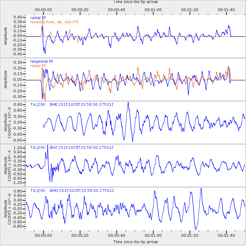
J20K Nowitna River, AK, USA - Earthquake Result Viewer
*The percent match for this event was below the threshold and hence no stack was calculated.
| Earthquake location: |
Santa Cruz Islands |
| Earthquake latitude/longitude: |
-11.0/166.4 |
| Earthquake time(UTC): |
2015/10/28 (301) 20:46:41 GMT |
| Earthquake Depth: |
152 km |
| Earthquake Magnitude: |
5.8 MWB |
| Earthquake Catalog/Contributor: |
NEIC PDE/NEIC COMCAT |
|
| Network: |
TA USArray Transportable Network (new EarthScope stations) |
| Station: |
J20K Nowitna River, AK, USA |
| Lat/Lon: |
64.18 N/154.15 W |
| Elevation: |
314 m |
|
| Distance: |
80.7 deg |
| Az: |
16.39 deg |
| Baz: |
219.244 deg |
| Ray Param: |
$rayparam |
*The percent match for this event was below the threshold and hence was not used in the summary stack. |
|
| Radial Match: |
53.354225 % |
| Radial Bump: |
400 |
| Transverse Match: |
33.536606 % |
| Transverse Bump: |
400 |
| SOD ConfigId: |
7422571 |
| Insert Time: |
2019-04-21 05:13:53.822 +0000 |
| GWidth: |
2.5 |
| Max Bumps: |
400 |
| Tol: |
0.001 |
|
Signal To Noise
| Channel | StoN | STA | LTA |
| TA:J20K: :BHZ:20151028T20:58:06.27501Z | 3.9499352 | 5.8016445E-7 | 1.4687949E-7 |
| TA:J20K: :BHN:20151028T20:58:06.27501Z | 1.6811397 | 3.2919687E-7 | 1.9581768E-7 |
| TA:J20K: :BHE:20151028T20:58:06.27501Z | 1.1280508 | 3.2233228E-7 | 2.857427E-7 |
| Arrivals |
| Ps | |
| PpPs | |
| PsPs/PpSs | |


