You are here: Home > Network List > TA - USArray Transportable Network (new EarthScope stations) Stations List
> Station O03E Paynes Creek, CA, USA > Earthquake Result Viewer
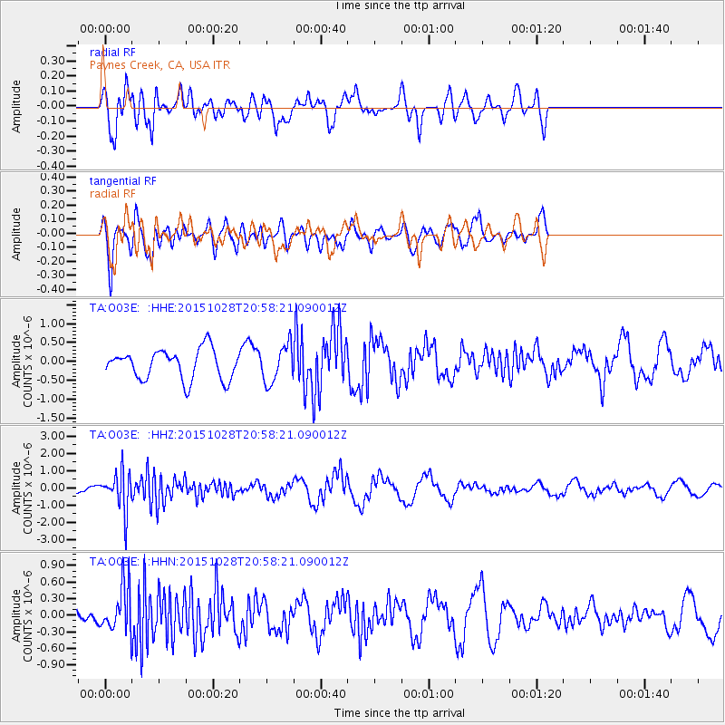
O03E Paynes Creek, CA, USA - Earthquake Result Viewer
*The percent match for this event was below the threshold and hence no stack was calculated.
| Earthquake location: |
Santa Cruz Islands |
| Earthquake latitude/longitude: |
-11.0/166.4 |
| Earthquake time(UTC): |
2015/10/28 (301) 20:46:41 GMT |
| Earthquake Depth: |
152 km |
| Earthquake Magnitude: |
5.8 MWB |
| Earthquake Catalog/Contributor: |
NEIC PDE/NEIC COMCAT |
|
| Network: |
TA USArray Transportable Network (new EarthScope stations) |
| Station: |
O03E Paynes Creek, CA, USA |
| Lat/Lon: |
40.29 N/121.80 W |
| Elevation: |
967 m |
|
| Distance: |
83.5 deg |
| Az: |
46.998 deg |
| Baz: |
249.863 deg |
| Ray Param: |
$rayparam |
*The percent match for this event was below the threshold and hence was not used in the summary stack. |
|
| Radial Match: |
71.953255 % |
| Radial Bump: |
400 |
| Transverse Match: |
71.86017 % |
| Transverse Bump: |
400 |
| SOD ConfigId: |
7422571 |
| Insert Time: |
2019-04-21 05:14:05.387 +0000 |
| GWidth: |
2.5 |
| Max Bumps: |
400 |
| Tol: |
0.001 |
|
Signal To Noise
| Channel | StoN | STA | LTA |
| TA:O03E: :HHZ:20151028T20:58:21.090012Z | 4.388777 | 1.1430368E-6 | 2.6044543E-7 |
| TA:O03E: :HHN:20151028T20:58:21.090012Z | 1.3323736 | 4.132516E-7 | 3.1016194E-7 |
| TA:O03E: :HHE:20151028T20:58:21.090012Z | 1.3953938 | 5.510866E-7 | 3.9493267E-7 |
| Arrivals |
| Ps | |
| PpPs | |
| PsPs/PpSs | |


