You are here: Home > Network List > US - United States National Seismic Network Stations List
> Station LAO LASA Array, Montana, USA > Earthquake Result Viewer
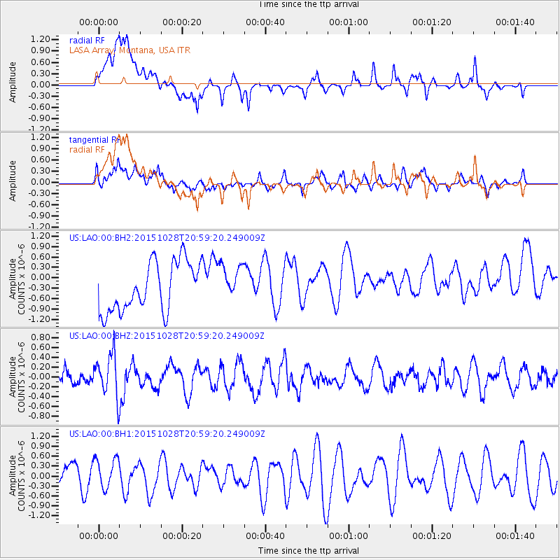
LAO LASA Array, Montana, USA - Earthquake Result Viewer
*The percent match for this event was below the threshold and hence no stack was calculated.
| Earthquake location: |
Santa Cruz Islands |
| Earthquake latitude/longitude: |
-11.0/166.4 |
| Earthquake time(UTC): |
2015/10/28 (301) 20:46:41 GMT |
| Earthquake Depth: |
152 km |
| Earthquake Magnitude: |
5.8 MWB |
| Earthquake Catalog/Contributor: |
NEIC PDE/NEIC COMCAT |
|
| Network: |
US United States National Seismic Network |
| Station: |
LAO LASA Array, Montana, USA |
| Lat/Lon: |
46.69 N/106.22 W |
| Elevation: |
902 m |
|
| Distance: |
96.1 deg |
| Az: |
43.76 deg |
| Baz: |
260.59 deg |
| Ray Param: |
$rayparam |
*The percent match for this event was below the threshold and hence was not used in the summary stack. |
|
| Radial Match: |
59.753242 % |
| Radial Bump: |
400 |
| Transverse Match: |
50.08381 % |
| Transverse Bump: |
400 |
| SOD ConfigId: |
7422571 |
| Insert Time: |
2019-04-21 05:14:28.824 +0000 |
| GWidth: |
2.5 |
| Max Bumps: |
400 |
| Tol: |
0.001 |
|
Signal To Noise
| Channel | StoN | STA | LTA |
| US:LAO:00:BHZ:20151028T20:59:20.249009Z | 1.387387 | 4.2761127E-7 | 3.082134E-7 |
| US:LAO:00:BH1:20151028T20:59:20.249009Z | 1.0880898 | 4.862259E-7 | 4.468619E-7 |
| US:LAO:00:BH2:20151028T20:59:20.249009Z | 0.68797356 | 4.875091E-7 | 7.08616E-7 |
| Arrivals |
| Ps | |
| PpPs | |
| PsPs/PpSs | |


