You are here: Home > Network List > TA - USArray Transportable Network (new EarthScope stations) Stations List
> Station O03E Paynes Creek, CA, USA > Earthquake Result Viewer
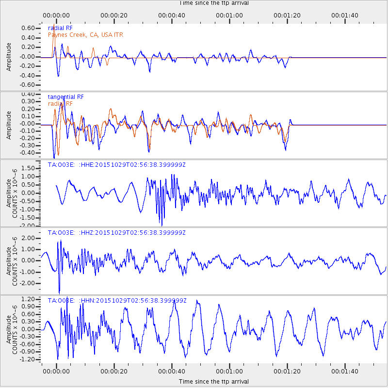
O03E Paynes Creek, CA, USA - Earthquake Result Viewer
*The percent match for this event was below the threshold and hence no stack was calculated.
| Earthquake location: |
Rat Islands, Aleutian Islands |
| Earthquake latitude/longitude: |
51.8/178.5 |
| Earthquake time(UTC): |
2015/10/29 (302) 02:49:28 GMT |
| Earthquake Depth: |
88 km |
| Earthquake Magnitude: |
5.6 MB |
| Earthquake Catalog/Contributor: |
NEIC PDE/NEIC COMCAT |
|
| Network: |
TA USArray Transportable Network (new EarthScope stations) |
| Station: |
O03E Paynes Creek, CA, USA |
| Lat/Lon: |
40.29 N/121.80 W |
| Elevation: |
967 m |
|
| Distance: |
41.9 deg |
| Az: |
81.628 deg |
| Baz: |
306.591 deg |
| Ray Param: |
$rayparam |
*The percent match for this event was below the threshold and hence was not used in the summary stack. |
|
| Radial Match: |
58.589523 % |
| Radial Bump: |
400 |
| Transverse Match: |
72.06567 % |
| Transverse Bump: |
400 |
| SOD ConfigId: |
7422571 |
| Insert Time: |
2019-04-21 05:24:37.446 +0000 |
| GWidth: |
2.5 |
| Max Bumps: |
400 |
| Tol: |
0.001 |
|
Signal To Noise
| Channel | StoN | STA | LTA |
| TA:O03E: :HHZ:20151029T02:56:38.399999Z | 2.8487866 | 1.0411844E-6 | 3.6548346E-7 |
| TA:O03E: :HHN:20151029T02:56:38.399999Z | 1.7598891 | 6.150261E-7 | 3.4946868E-7 |
| TA:O03E: :HHE:20151029T02:56:38.399999Z | 1.9502515 | 6.551572E-7 | 3.3593471E-7 |
| Arrivals |
| Ps | |
| PpPs | |
| PsPs/PpSs | |


