You are here: Home > Network List > TA - USArray Transportable Network (new EarthScope stations) Stations List
> Station O48A Farmland, IN, USA > Earthquake Result Viewer
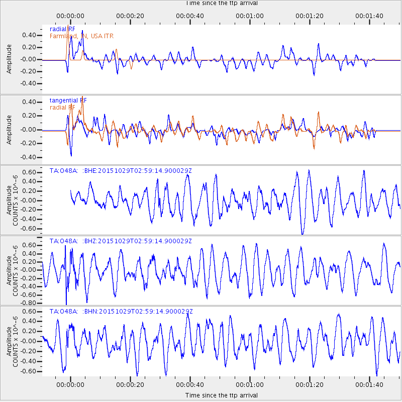
O48A Farmland, IN, USA - Earthquake Result Viewer
*The percent match for this event was below the threshold and hence no stack was calculated.
| Earthquake location: |
Rat Islands, Aleutian Islands |
| Earthquake latitude/longitude: |
51.8/178.5 |
| Earthquake time(UTC): |
2015/10/29 (302) 02:49:28 GMT |
| Earthquake Depth: |
88 km |
| Earthquake Magnitude: |
5.6 MB |
| Earthquake Catalog/Contributor: |
NEIC PDE/NEIC COMCAT |
|
| Network: |
TA USArray Transportable Network (new EarthScope stations) |
| Station: |
O48A Farmland, IN, USA |
| Lat/Lon: |
40.26 N/85.16 W |
| Elevation: |
300 m |
|
| Distance: |
63.1 deg |
| Az: |
58.521 deg |
| Baz: |
316.231 deg |
| Ray Param: |
$rayparam |
*The percent match for this event was below the threshold and hence was not used in the summary stack. |
|
| Radial Match: |
55.04242 % |
| Radial Bump: |
400 |
| Transverse Match: |
61.894043 % |
| Transverse Bump: |
400 |
| SOD ConfigId: |
7422571 |
| Insert Time: |
2019-04-21 05:24:38.046 +0000 |
| GWidth: |
2.5 |
| Max Bumps: |
400 |
| Tol: |
0.001 |
|
Signal To Noise
| Channel | StoN | STA | LTA |
| TA:O48A: :BHZ:20151029T02:59:14.900029Z | 1.2565526 | 2.9232046E-7 | 2.3263688E-7 |
| TA:O48A: :BHN:20151029T02:59:14.900029Z | 0.9769063 | 2.1105923E-7 | 2.160486E-7 |
| TA:O48A: :BHE:20151029T02:59:14.900029Z | 1.6668872 | 2.3452338E-7 | 1.4069542E-7 |
| Arrivals |
| Ps | |
| PpPs | |
| PsPs/PpSs | |


