You are here: Home > Network List > TA - USArray Transportable Network (new EarthScope stations) Stations List
> Station T25A Trinidad, CO, USA > Earthquake Result Viewer
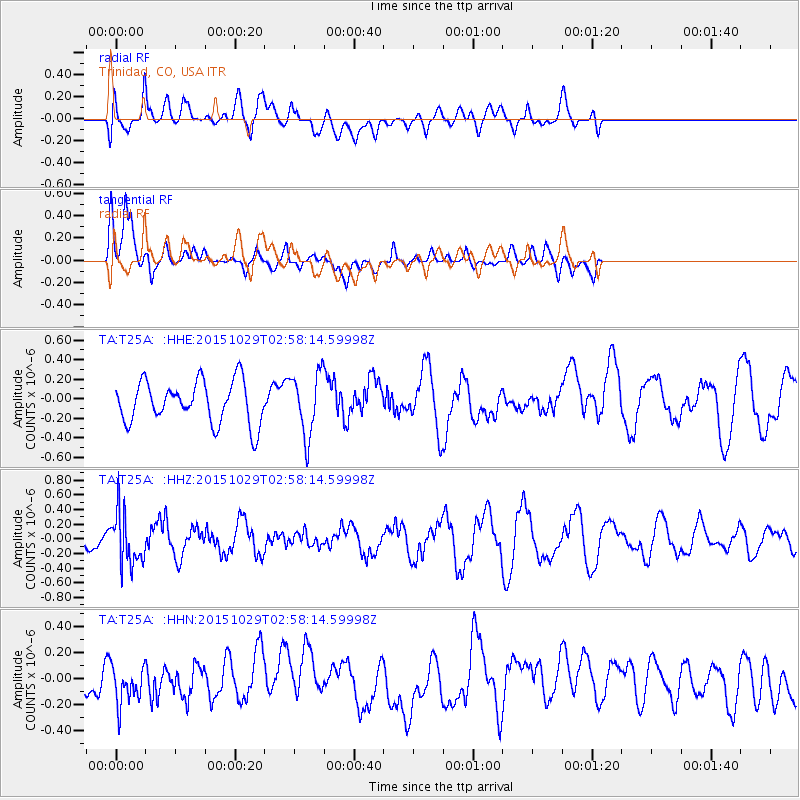
T25A Trinidad, CO, USA - Earthquake Result Viewer
*The percent match for this event was below the threshold and hence no stack was calculated.
| Earthquake location: |
Rat Islands, Aleutian Islands |
| Earthquake latitude/longitude: |
51.8/178.5 |
| Earthquake time(UTC): |
2015/10/29 (302) 02:49:28 GMT |
| Earthquake Depth: |
88 km |
| Earthquake Magnitude: |
5.6 MB |
| Earthquake Catalog/Contributor: |
NEIC PDE/NEIC COMCAT |
|
| Network: |
TA USArray Transportable Network (new EarthScope stations) |
| Station: |
T25A Trinidad, CO, USA |
| Lat/Lon: |
37.14 N/104.41 W |
| Elevation: |
2017 m |
|
| Distance: |
54.4 deg |
| Az: |
73.344 deg |
| Baz: |
311.911 deg |
| Ray Param: |
$rayparam |
*The percent match for this event was below the threshold and hence was not used in the summary stack. |
|
| Radial Match: |
46.13673 % |
| Radial Bump: |
400 |
| Transverse Match: |
76.035164 % |
| Transverse Bump: |
400 |
| SOD ConfigId: |
7422571 |
| Insert Time: |
2019-04-21 05:24:42.664 +0000 |
| GWidth: |
2.5 |
| Max Bumps: |
400 |
| Tol: |
0.001 |
|
Signal To Noise
| Channel | StoN | STA | LTA |
| TA:T25A: :HHZ:20151029T02:58:14.59998Z | 2.1395943 | 3.5835723E-7 | 1.674884E-7 |
| TA:T25A: :HHN:20151029T02:58:14.59998Z | 0.8204198 | 1.6011734E-7 | 1.9516513E-7 |
| TA:T25A: :HHE:20151029T02:58:14.59998Z | 1.5282327 | 3.277257E-7 | 2.1444751E-7 |
| Arrivals |
| Ps | |
| PpPs | |
| PsPs/PpSs | |


