You are here: Home > Network List > TA - USArray Transportable Network (new EarthScope stations) Stations List
> Station 121A Cookes Peak, Deming, NM, USA > Earthquake Result Viewer
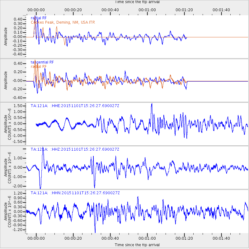
121A Cookes Peak, Deming, NM, USA - Earthquake Result Viewer
*The percent match for this event was below the threshold and hence no stack was calculated.
| Earthquake location: |
Northern Chile |
| Earthquake latitude/longitude: |
-23.2/-68.2 |
| Earthquake time(UTC): |
2015/11/01 (305) 15:16:14 GMT |
| Earthquake Depth: |
80 km |
| Earthquake Magnitude: |
5.8 MB |
| Earthquake Catalog/Contributor: |
NEIC PDE/NEIC COMCAT |
|
| Network: |
TA USArray Transportable Network (new EarthScope stations) |
| Station: |
121A Cookes Peak, Deming, NM, USA |
| Lat/Lon: |
32.53 N/107.79 W |
| Elevation: |
1652 m |
|
| Distance: |
67.1 deg |
| Az: |
324.254 deg |
| Baz: |
140.482 deg |
| Ray Param: |
$rayparam |
*The percent match for this event was below the threshold and hence was not used in the summary stack. |
|
| Radial Match: |
72.004684 % |
| Radial Bump: |
400 |
| Transverse Match: |
68.451385 % |
| Transverse Bump: |
400 |
| SOD ConfigId: |
7422571 |
| Insert Time: |
2019-04-21 05:33:56.019 +0000 |
| GWidth: |
2.5 |
| Max Bumps: |
400 |
| Tol: |
0.001 |
|
Signal To Noise
| Channel | StoN | STA | LTA |
| TA:121A: :HHZ:20151101T15:26:27.690027Z | 5.4409866 | 1.0910475E-6 | 2.0052383E-7 |
| TA:121A: :HHN:20151101T15:26:27.690027Z | 1.6564683 | 3.35616E-7 | 2.0260937E-7 |
| TA:121A: :HHE:20151101T15:26:27.690027Z | 1.319898 | 3.0784074E-7 | 2.3323071E-7 |
| Arrivals |
| Ps | |
| PpPs | |
| PsPs/PpSs | |


