You are here: Home > Network List > GS - US Geological Survey Networks Stations List
> Station KAN11 Stewart Ranch, Harper County, KS, USA > Earthquake Result Viewer
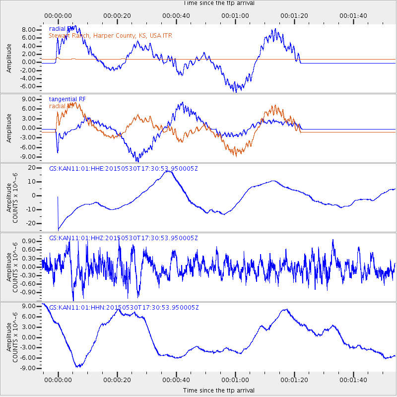
KAN11 Stewart Ranch, Harper County, KS, USA - Earthquake Result Viewer
*The percent match for this event was below the threshold and hence no stack was calculated.
| Earthquake location: |
Tonga Islands |
| Earthquake latitude/longitude: |
-15.7/-173.3 |
| Earthquake time(UTC): |
2015/05/30 (150) 17:18:39 GMT |
| Earthquake Depth: |
51 km |
| Earthquake Magnitude: |
5.8 MB |
| Earthquake Catalog/Contributor: |
NEIC PDE/NEIC COMCAT |
|
| Network: |
GS US Geological Survey Networks |
| Station: |
KAN11 Stewart Ranch, Harper County, KS, USA |
| Lat/Lon: |
37.21 N/97.91 W |
| Elevation: |
410 m |
|
| Distance: |
88.2 deg |
| Az: |
50.628 deg |
| Baz: |
248.81 deg |
| Ray Param: |
$rayparam |
*The percent match for this event was below the threshold and hence was not used in the summary stack. |
|
| Radial Match: |
41.43964 % |
| Radial Bump: |
400 |
| Transverse Match: |
51.690857 % |
| Transverse Bump: |
303 |
| SOD ConfigId: |
976571 |
| Insert Time: |
2015-06-13 17:55:44.132 +0000 |
| GWidth: |
2.5 |
| Max Bumps: |
400 |
| Tol: |
0.001 |
|
Signal To Noise
| Channel | StoN | STA | LTA |
| GS:KAN11:01:HHZ:20150530T17:30:53.950005Z | 1.9938879 | 4.3426945E-7 | 2.1780033E-7 |
| GS:KAN11:01:HHN:20150530T17:30:53.950005Z | 0.5975649 | 7.67273E-6 | 1.2839994E-5 |
| GS:KAN11:01:HHE:20150530T17:30:53.950005Z | 3.731021 | 1.7511458E-5 | 4.6934765E-6 |
| Arrivals |
| Ps | |
| PpPs | |
| PsPs/PpSs | |


