You are here: Home > Network List > TA - USArray Transportable Network (new EarthScope stations) Stations List
> Station Z41A Richland Creek Farm, El Dorado, AR, USA > Earthquake Result Viewer
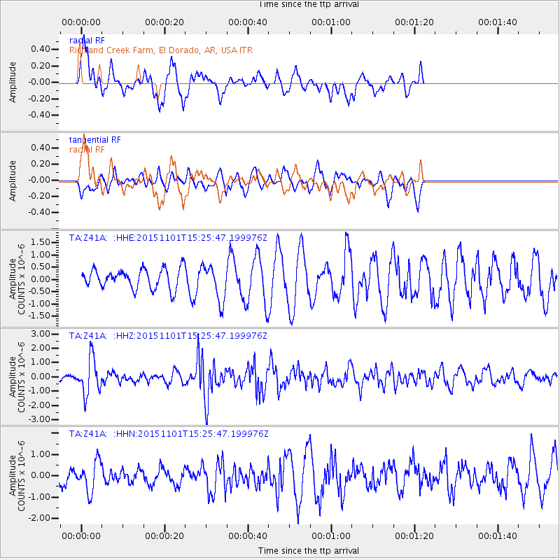
Z41A Richland Creek Farm, El Dorado, AR, USA - Earthquake Result Viewer
*The percent match for this event was below the threshold and hence no stack was calculated.
| Earthquake location: |
Northern Chile |
| Earthquake latitude/longitude: |
-23.2/-68.2 |
| Earthquake time(UTC): |
2015/11/01 (305) 15:16:14 GMT |
| Earthquake Depth: |
80 km |
| Earthquake Magnitude: |
5.8 MB |
| Earthquake Catalog/Contributor: |
NEIC PDE/NEIC COMCAT |
|
| Network: |
TA USArray Transportable Network (new EarthScope stations) |
| Station: |
Z41A Richland Creek Farm, El Dorado, AR, USA |
| Lat/Lon: |
33.26 N/92.80 W |
| Elevation: |
62 m |
|
| Distance: |
60.8 deg |
| Az: |
336.474 deg |
| Baz: |
154.003 deg |
| Ray Param: |
$rayparam |
*The percent match for this event was below the threshold and hence was not used in the summary stack. |
|
| Radial Match: |
61.936646 % |
| Radial Bump: |
400 |
| Transverse Match: |
36.194748 % |
| Transverse Bump: |
373 |
| SOD ConfigId: |
7422571 |
| Insert Time: |
2019-04-21 05:34:25.995 +0000 |
| GWidth: |
2.5 |
| Max Bumps: |
400 |
| Tol: |
0.001 |
|
Signal To Noise
| Channel | StoN | STA | LTA |
| TA:Z41A: :HHZ:20151101T15:25:47.199976Z | 4.739219 | 1.289444E-6 | 2.720794E-7 |
| TA:Z41A: :HHN:20151101T15:25:47.199976Z | 2.0086064 | 7.3722845E-7 | 3.6703477E-7 |
| TA:Z41A: :HHE:20151101T15:25:47.199976Z | 1.8782587 | 7.527701E-7 | 4.0078086E-7 |
| Arrivals |
| Ps | |
| PpPs | |
| PsPs/PpSs | |


